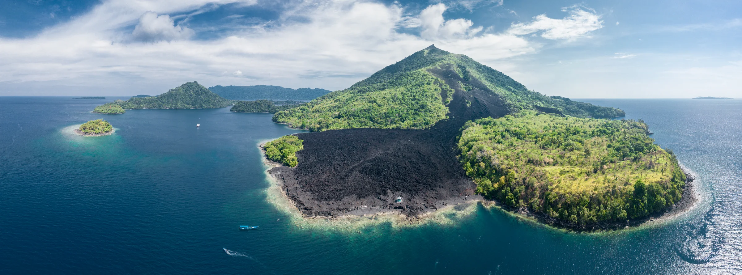
Aerial panorama of a cone-shaped island with green slopes, a broad dark strip of bare ground reaching the shoreline, and small boats offshore.

Rascal Voyages · Maluku, Indonesia

The Spice
Islands

Ambon & the Banda Sea

↓Photo details

Island atlas

Explore the islands

The stories

Maluku, Ambon & Banda

Choose a chapter
  1. 01 Maluku before the Europeans
  2. 02 Ambon: cloves and coastal kingdoms
  3. 03 Nutmeg and mace
  4. 04 Rhun and the Treaty of Breda
  5. 05 Ai: settlement and conquest
  6. 06 Banda Neira and the VOC
  7. 07 Nutmeg beyond Banda
  8. 08 Hatta and Sjahrir in exile
  9. 09 Belang, kabata and Mama Lima
  10. 10 Banda Api’s 1988 eruption
  11. 11 Hammerheads in the Banda Sea
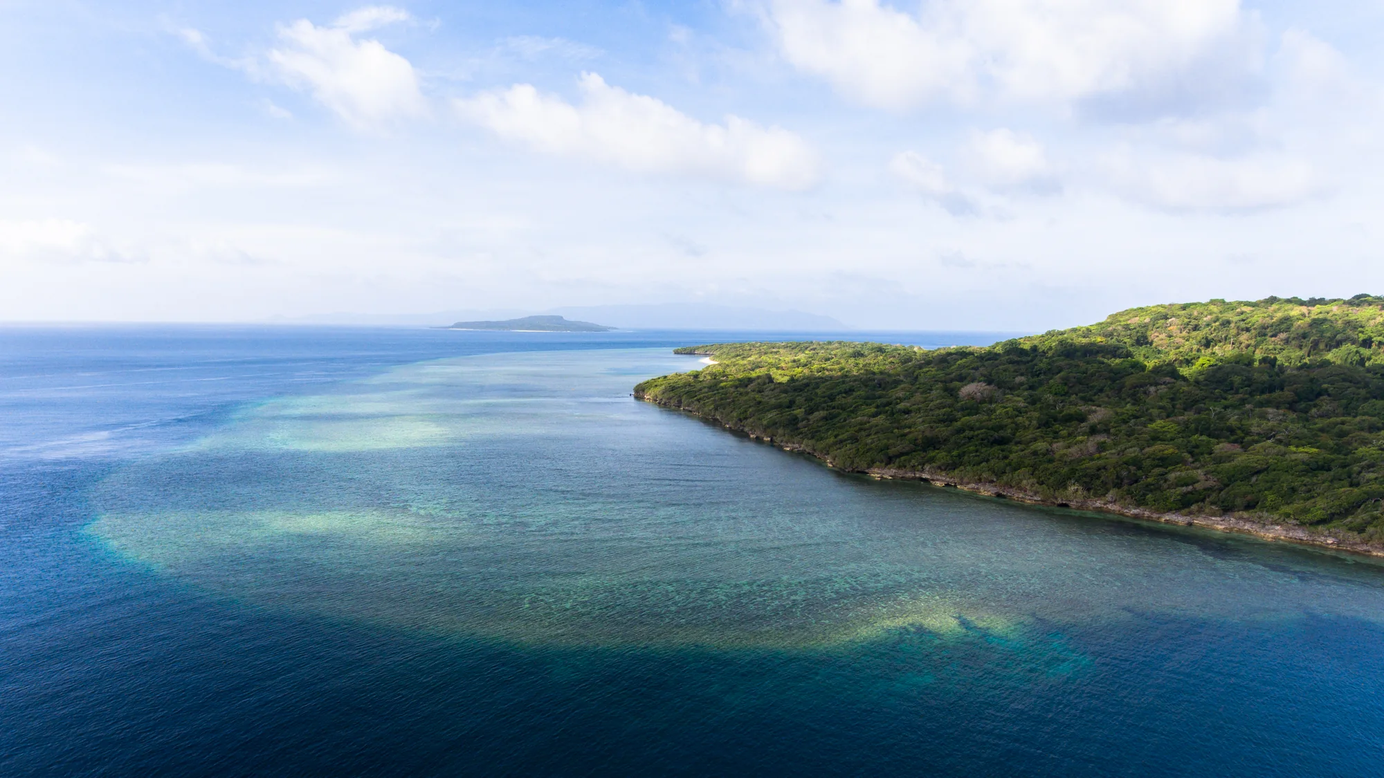
A forested coastline curves beside bands of pale turquoise water and deeper blue sea, with low islands on the horizon.
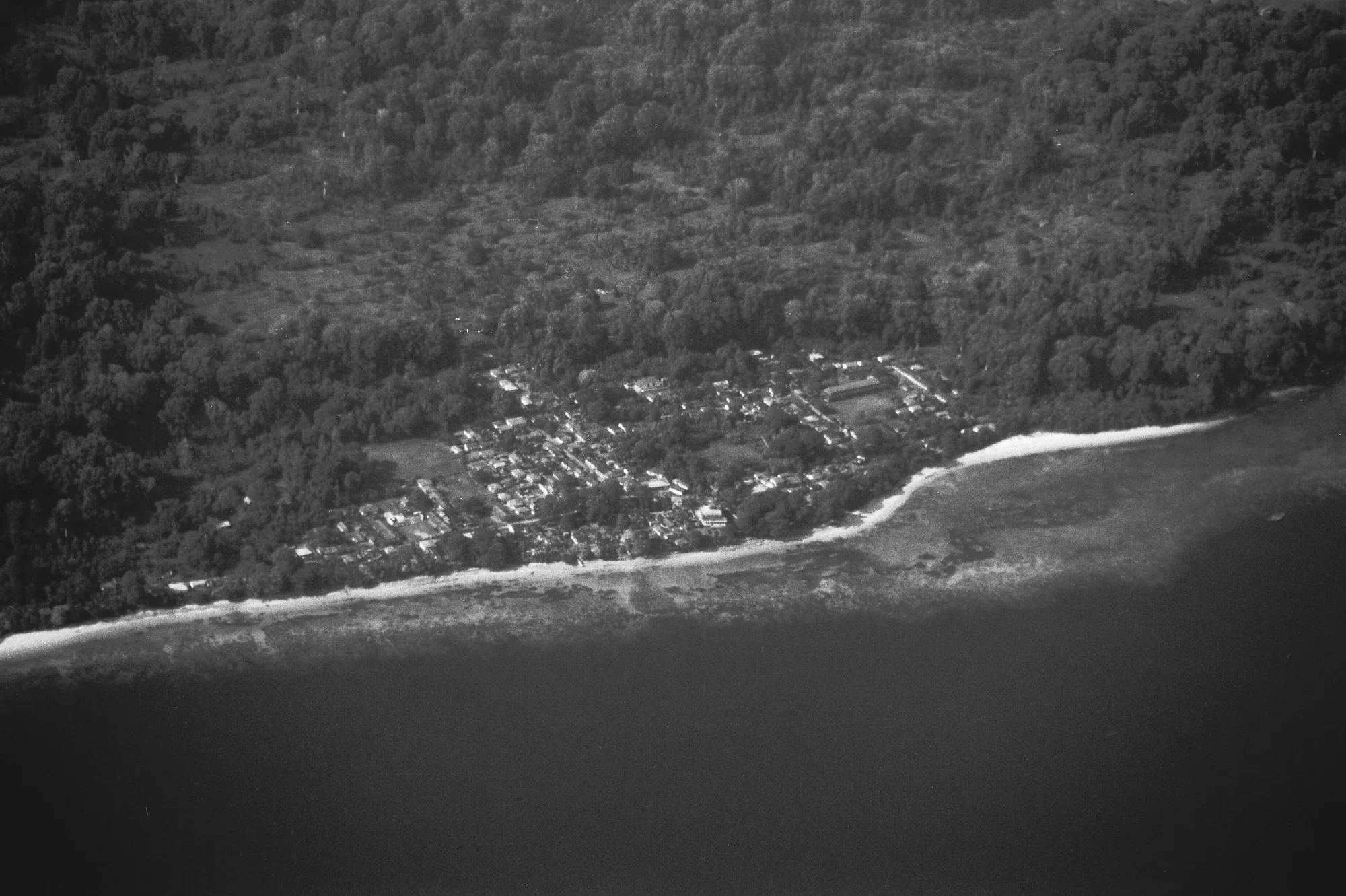
A monochrome aerial photograph shows a tree-covered coastline, clustered roofs, a pale beach and dark water.

01 Pulau Ai · food, voyages and belief

Maluku before the Europeans

About 3,500 years ago, someone on Pulau Ai was cooking with nutmeg. Traces of it survive on broken pots from a settlement known as PA1, along with traces of sago and purple yam. The people living there left fish bones, tools and the marks of wooden posts in the ground above a small beach on the island's southwest coast.

Another site on Ai takes us much further back. People were using the PA11 rock shelter roughly 7,700 years ago, long before pottery appeared at the later settlement. Reaching these islands meant crossing open water. Even when sea levels were lower, Banda had no land bridge connecting it to either the Asian or Australian continent.

Dishes from China eventually found their way into Bandanese homes. On Neira, a piece of Chinese pottery came from a layer dated between 560 and 770 CE. Banda is also named in the Chinese Dade Nanhai zhi of 1304 and the Javanese Desawarnana of 1365. Growers, traders and visiting ships linked the islands to markets far beyond the Banda Sea.

Neighbours did not always share the same beliefs. At one Neira site, no pig remains were found from around 1200 CE, leading archaeologist Peter Lape to suggest an early Muslim community. Nearby Labbetacca had pig bones and burned human remains thought to be cremation burials. Written histories and archaeology give different dates for Islam's arrival. Communities adopted the religion at different times.

View on the map
Read more

On Gebe, farther north, people were using Golo Cave about 35,000–36,000 years ago. They left worked shell and stone; later deposits contain bone tools and shell adzes with ground cutting edges. At Uattamdi on Kayoa, pottery with a red coating and shell ornaments appeared roughly 3,000–3,300 years ago. Over the following millennium came metal objects, glass beads and burials in jars.

The pots on Ai changed as the settlement grew older. Early ones had thin walls and long rims that turned outwards, a useful shape for storing liquids. Later pots had thicker walls, coarser material mixed into the clay and shorter rims suited to cooking. A red coating covered many of the early pots, becoming less common later. Some pieces also had geometric patterns cut or pressed into them.

Fish remains were plentiful in the earliest PA1 layers, with very little mammal bone. Several centuries later, domesticated pigs had become much more important; archaeologists also found a few dog bones. Among the pots were small chert flakes and scrapers, and pieces of obsidian. Tests could not match the obsidian to the known sources used for comparison, leaving its place of origin unidentified.

People largely left the open settlement around 2,300 years ago. The excavation team had not found another Bandanese site that filled the whole gap that followed. Living permanently on these small islands took more planning for food and stored water than an occasional fishing visit. The researchers suggested that earlier visitors may have sailed from Seram, the nearest large island, using their knowledge of the sea to make repeated crossings.

Food was one way Lape traced the spread of religion. In the settlement where people continued eating pork, leaders did not carry the Muslim title imam used in other villages. He compared 21 sites across three islands, using old maps and descriptions of village alliances alongside the excavations. Some villages shown on those maps were abandoned under Dutch occupation, so he could connect material in the ground with named communities.
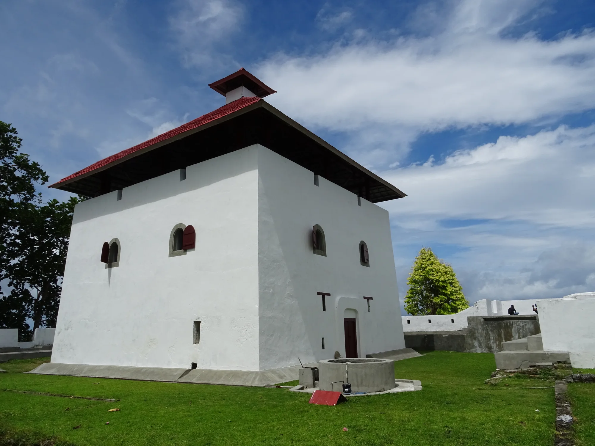
A pale masonry building with a steep red roof and low stone walls stands beside a grassy path and trees.
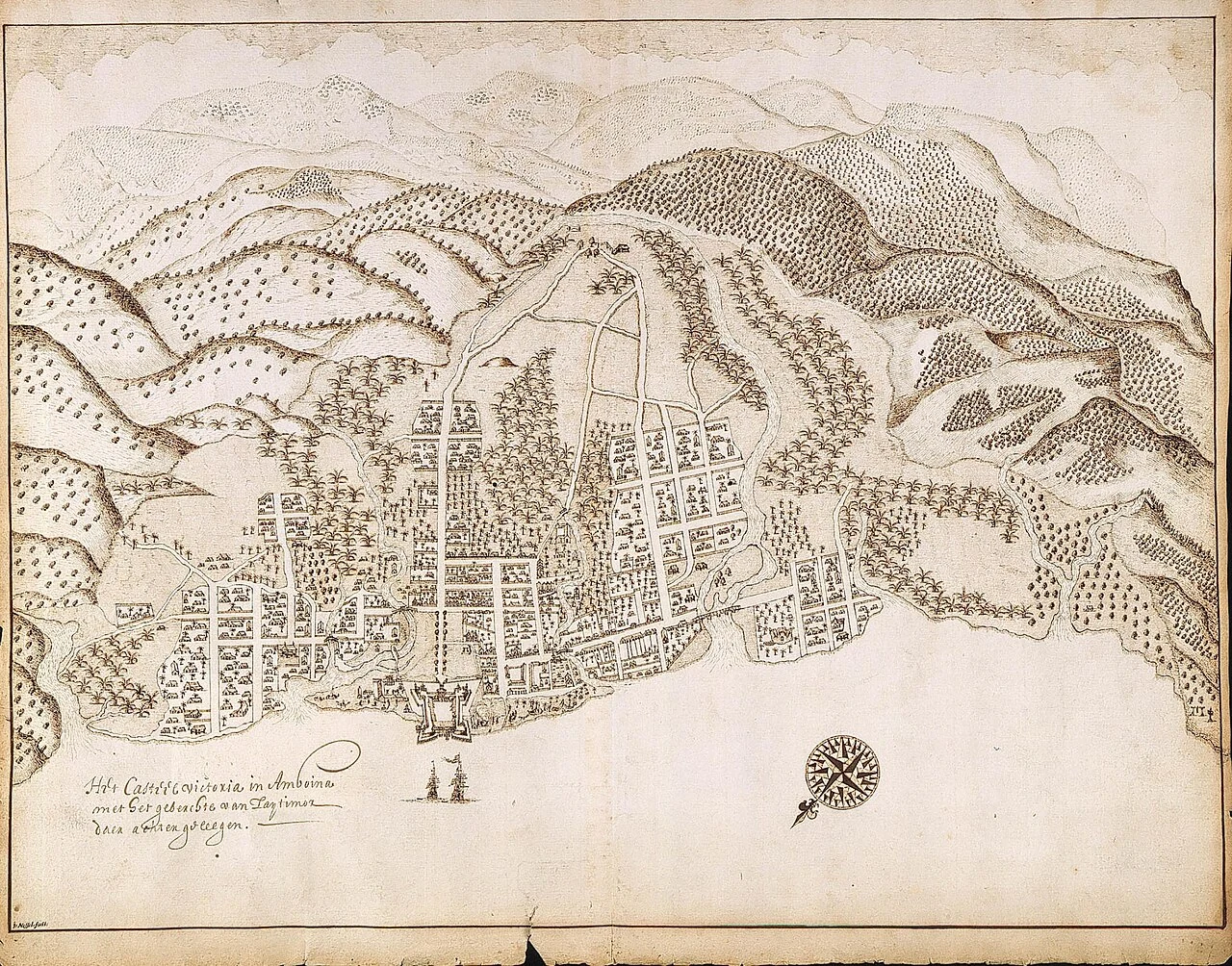
A historic pen drawing shows a coastal town, a walled fort, trees and hills, with a compass rose and handwritten labels.

02 Ambon · Hitu and the clove ports

Ambon: cloves and coastal kingdoms

A clove is a flower bud picked before it opens, then dried. It grows on Syzygium aromaticum, a tree native to Maluku. Cargoes passed through Ambon's ports, where coastal rulers traded with merchants and made military alliances. Hitu, on the northern peninsula, had its own ambitions and interests before European fleets joined the trade.

In 1605, Hitu's rulers asked the Dutch to help drive out the Portuguese. The VOC took the Portuguese fort, then secured an agreement that Hitu would sell its cloves only to the company. A fixed price followed. The new ally now had a say in the crop, the harvest and who was allowed to buy it.

These trading companies could also make treaties and fight wars. The English East India Company was founded in 1600, followed by the Dutch VOC in 1602. Agreements offering protection helped them shut out competing buyers. When price alone could not secure the trade they wanted, they could call on soldiers and forts to enforce their claims.

The VOC also employed Georg Eberhard Rumphius, who collected shells and studied plants along Ambon's shores. His Ambonese Herbal and Ambonese Curiosity Cabinet brought together local names, useful plants and marine animals. Island people shared knowledge, supplied specimens and helped with the work. Later naturalists returned to Ambon to investigate what he had found.

View on the map

Passing up the harbour, in appearance like a fine river, the clearness of the water afforded me one of the most astonishing and beautiful sights I have ever beheld. The bottom was absolutely hidden by a continuous series of corals, sponges, actiniae, and other marine productions of magnificent dimensions, varied forms, and brilliant colours. The depth varied from about twenty to fifty feet, and the bottom was very uneven, rocks and chasms and little hills and valleys, offering a variety of stations for the growth of these animal forests.

Alfred Russel Wallace, 1869
Read more

Rijali, an imam from Hitu, wrote the Hikayat Tanah Hitu during his exile in Makassar between 1647 and 1653. He tells of islanders finding unfamiliar sailors in a boat and taking them to Jamilu, one of Hitu's leaders. They welcomed the visitors, traded and exchanged gifts of cloth. Later, drunken newcomers caused trouble in the market, and Hitu's leaders moved them elsewhere. Rijali wrote in Malay using Jawi, a script based on Arabic.

Five small volcanic islands off Halmahera were at the heart of clove growing: Ternate, Tidore, Moti, Makian and Bacan. The sultans of Ternate and Tidore built trading links and political alliances across the surrounding seas. In 1607, the VOC built a fort on Ternate to help its sultan resist Spanish forces arriving from the Philippines. In return for military support, the company claimed the right to buy all the cloves grown in his territories.

The trade reached east into New Guinea. Bird-of-paradise skins passed through Raja Ampat on their way west towards Tidore. People from Waigeo carried sago and pearl shell to Salawati and Tidore, while coastal traders dealt with hunters inland. On Ambon, Rumphius obtained plumes said to come from Sergile, around present-day Sorong. Cloth and metal tools went east in exchange. These routes joined the Malukan ports where spices were traded.

Shichizō, a 24-year-old from Hirado in Japan, appeared on the walls of Ambon's castle in 1623. His presence set off a series of interrogations. Dutch officials accused English merchants and Japanese mercenaries of plotting to seize the fort. The men had come through rival trading and military networks; Japanese soldiers were serving in VOC garrisons far from home. Interrogators forced confessions using water torture. They bound a prisoner's arms to a door frame, tied cloth over his face and poured water over his head until he could not breathe. The advocate-fiscal, Isaaq de Bruyn, led the proceedings. Their legality was challenged almost at once. Dutch law allowed torture under prescribed rules; the dispute was whether officials had followed those rules and whether the confessions proved the accusations.

The executions took place on 9 March 1623. News reached Europe the following year, and six English survivors returned in June 1624. Their testimony helped fuel a war of pamphlets. English and Dutch publications accused the other side of treason or judicial murder. The argument continued for decades, reaching people who knew Ambon only through what they read.

Rumphius went blind in 1670. Four years later, his wife and youngest daughter were killed in an earthquake while watching Chinese New Year celebrations. In 1687, a fire destroyed his house, drawings and many manuscripts. He carried on with assistants. A ship taking the first six books of his Herbal to Europe later sank, but a copy made in Batavia survived. The Curiosity Cabinet appeared after his death, in 1705; the Herbal followed between 1741 and 1750. A biohistorical expedition returned in 1990 to collect at places linked to his descriptions. Its station lists pair beaches, bays and village shores with the collections made there.

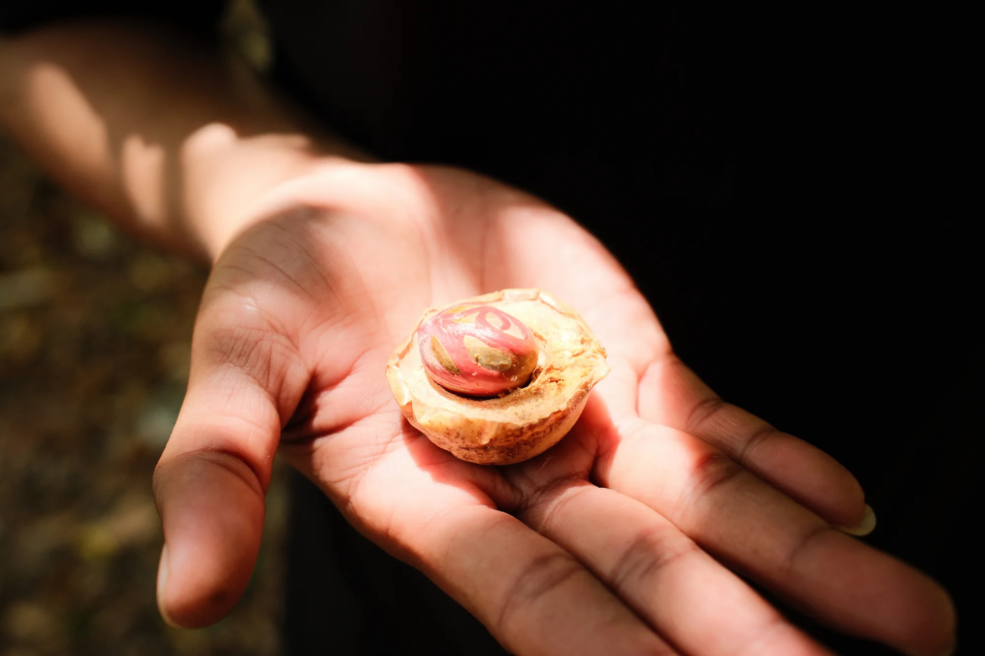
An open hand holds a cut yellow-brown fruit, showing red strands surrounding a dark central seed.
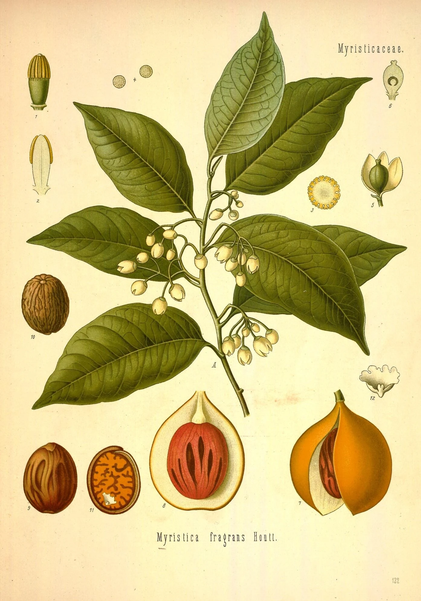
Colour botanical plate with a leafy branch, small flowers and numbered drawings of split fruit, seeds and flower parts.

03 The fruit and the work of cultivation

Nutmeg and mace

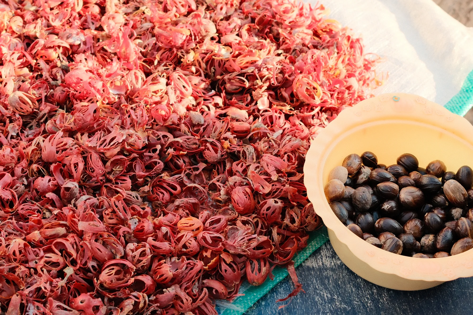
When the yellow fruit splits open, it reveals a glossy dark shell wrapped in a bright red lattice. The lattice is called the aril: dried, it is sold as mace. The kernel inside the shell is nutmeg. Both spices come from Myristica fragrans, an evergreen tree native to the Banda Islands. The fleshy outer fruit is used for preserves and jelly.

Small, pale flowers grow among the leaves. Most trees carry either male or female flowers, so a grove needs pollen-bearing trees alongside those that produce fruit. It takes years to discover which a new seedling will become. After a flower is fertilised, the fruit develops over roughly six to nine months before it is ready.

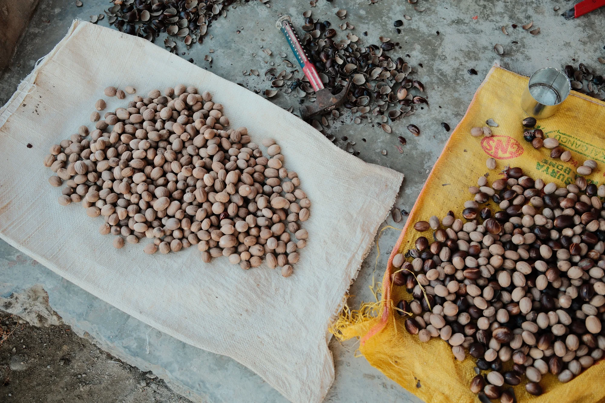
Harvesters reach the ripe fruit with a long pole fitted with a small blade and a basket to catch it. They remove the outer flesh and carefully separate the mace. Fresh mace is soft and scarlet. Drying makes it firmer and turns it towards orange and yellow. The seed takes longer to dry before its shell can be removed.

During drying, the seeds need turning, checking and protection from damp, which encourages mould. As a kernel dries, it loosens inside the shell and can rattle when shaken. The shell is then cracked to release the spice, and the kernels are sorted for damage and quality.

View on the map

The most remarkable is a fine and very handsome fruit-pigeon, Carpophaga concinna, which feeds upon the nutmegs, or rather on the mace, and whose loud booming note is to be continually heard. This bird is found in the Ke and Matabello islands as well as Banda, but not in Ceram or any of the larger islands, which are inhabited by allied but very distinct species.

Alfred Russel Wallace, 1869
Read more

The leaves grow alternately along the twigs. Each has a smooth edge, a glossy top and a paler underside; crushing it releases an aroma. Reddish sap can seep from a damaged stem. Below ground, the feeding roots spread close to the surface to take up water. Older trees sometimes develop projecting roots near the base of the trunk, and strong winds can topple the shallow-rooted trees.

Growers raise young trees from seed or use methods such as grafting. Singapore's botanical reference gives a germination time of one to two months. Nutmeg needs warmth and soil that drains well, because waterlogged ground can harm its roots. It also grows in partial shade. This tolerance allows it to grow beneath and among taller trees, with different amounts of light reaching its leaves.

Nutmeg's little bell-shaped flowers have no showy petals. Botanists studying how pollen gets to the female trees have found beetles doing the work. In a Kerala plantation, an ant-like flower beetle was identified as a pollinator. A study of a different wild Myristica species in Australia found several kinds of beetle visiting its flowers.

Early European botanists had to work with pieces of plants brought back with the cargoes. A specimen from the first Dutch trading expedition to Banda reached Carolus Clusius in Leiden. He published his description and illustration in 1605, showing the shoot with a fruit hanging from its end. He corrected three earlier ideas: that mace was the flower, that the blossom was clove, and that the leaves had serrated edges.

In Grenada, Guido Marcelle's FAO study followed seeds drying in shallow layers on stacked wooden trays inside buildings. Workers used rakes, cut samples open and checked their smell.

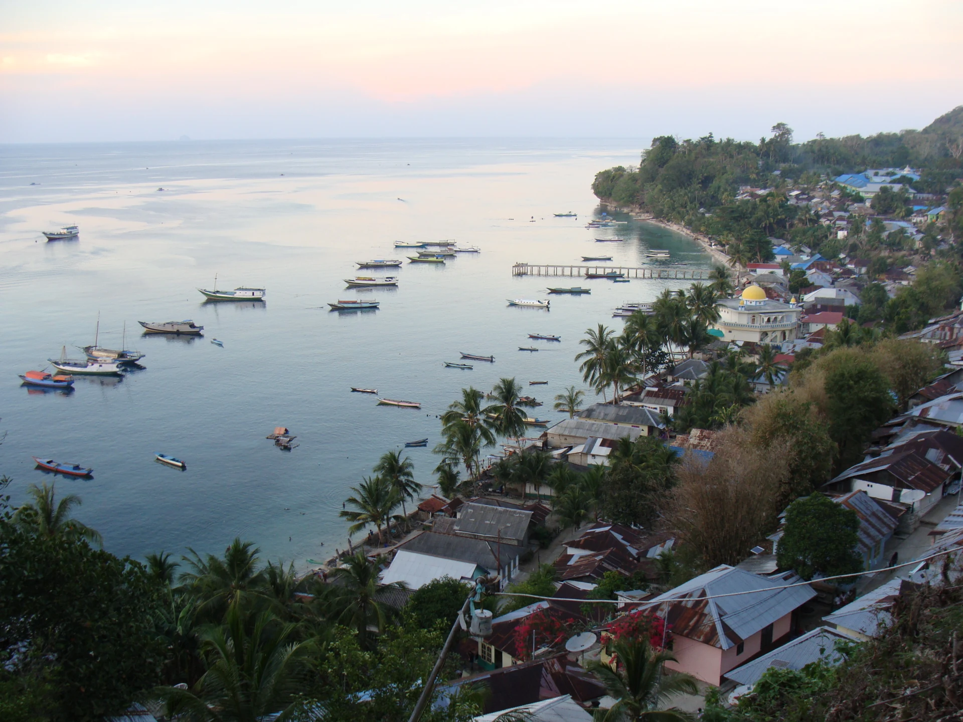
A hillside view of a coastal settlement with metal-roofed houses, palms, a white domed building, a pier and many small boats.
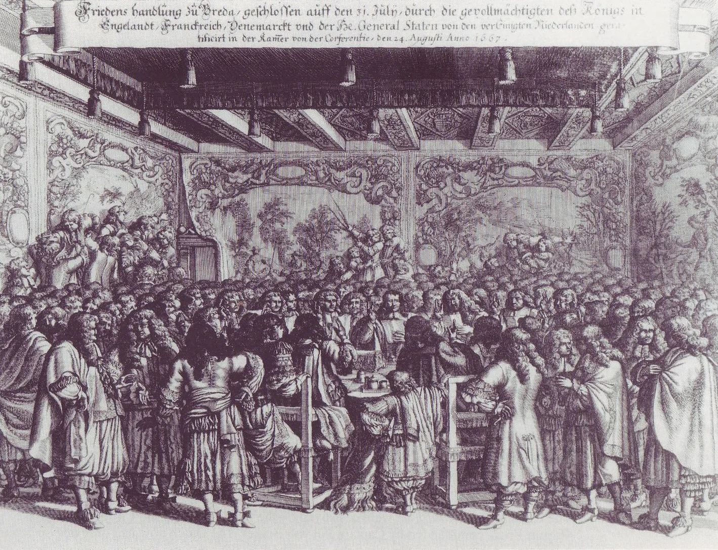
A monochrome engraving of people in a richly decorated hall, gathered around a central table beneath an inscribed banner.

04 Rhun / Run · a settlement across oceans

Rhun and the Treaty of Breda

A seventeenth-century Dutch news print shows delegates crowded around a table covered with documents. Above them, cherubs blow trumpets and a figure of Peace announces the negotiations at Breda. Elsewhere on the sheet are burning ships and the Great Fire of London. The settlement being negotiated during this European war also concerned a nutmeg island in the Banda Sea.

Rhun, also spelled Run, had become an English foothold close to the Dutch-controlled Banda islands. The Treaty of Westminster allowed English settlement there in 1654, but the VOC continued to obstruct it into the early 1660s. During the next Anglo-Dutch war, Dutch forces destroyed Rhun's nutmeg trees and drove out the English merchants.

The Treaty of Breda ended the Second Anglo-Dutch War on 31 July 1667. The Dutch kept Rhun and Suriname; England kept New Netherland, including New Amsterdam on Manhattan. The negotiations took place in the great hall of Breda Castle. France and Denmark-Norway also reached peace with England through associated treaties.

England had already taken the North American colony in 1664. Warships surrounded New Amsterdam, and Peter Stuyvesant surrendered. New Netherland stretched well beyond Manhattan, with river settlements and an economy built around the fur trade. At Breda three years later, the negotiators accepted English possession as they settled territorial claims across several oceans.

View on the map
Read more

War had begun in 1665. By summer 1667, much of the English fleet lay idle in the Medway, and London was still recovering from plague and fire. Dutch ships attacked the anchorage near Chatham, burned warships and towed away the Royal Charles. Peace talks were already under way. The raid strengthened the Dutch position and helped bring negotiations to a swift end when they resumed.

New Netherland's trade followed the Hudson, Delaware and Connecticut rivers. The Dutch West India Company sent settlers and traded with Indigenous communities for furs. Farms grew alongside the ports. Wealthy patrons received large estates, taking rent and a share of their tenants' crops. Land, trade and who held authority were already sources of conflict before the colony passed into English hands.

Marcus Doornick's 1667 news sheet told the story of the conflict through ten illustrated scenes. Its final celebration shows crowds beside a canal, with fireworks overhead.

A bronze medal made that year brings peace and naval victory together. On one side, Peace sits on captured weapons, holding an olive branch and a cornucopia beside the shields of European states. On the other, English ships burn near Chatham. The inscription names Michiel de Ruyter. The diplomatic settlement and the destruction of the fleet both appear on this small object, which could fit in a hand.

Another war broke out in 1672. Nine years after Stuyvesant's surrender, a Dutch fleet took New York back and renamed it New Orange. It stayed Dutch for only a year before another peace returned it to English rule. Through these changes of flag, Dutch families, language and institutions continued in the former colony as it became part of a different empire.

Small rounded kernels are spread on white and yellow sacks, with dark broken shells, a hand tool and a metal cup nearby.
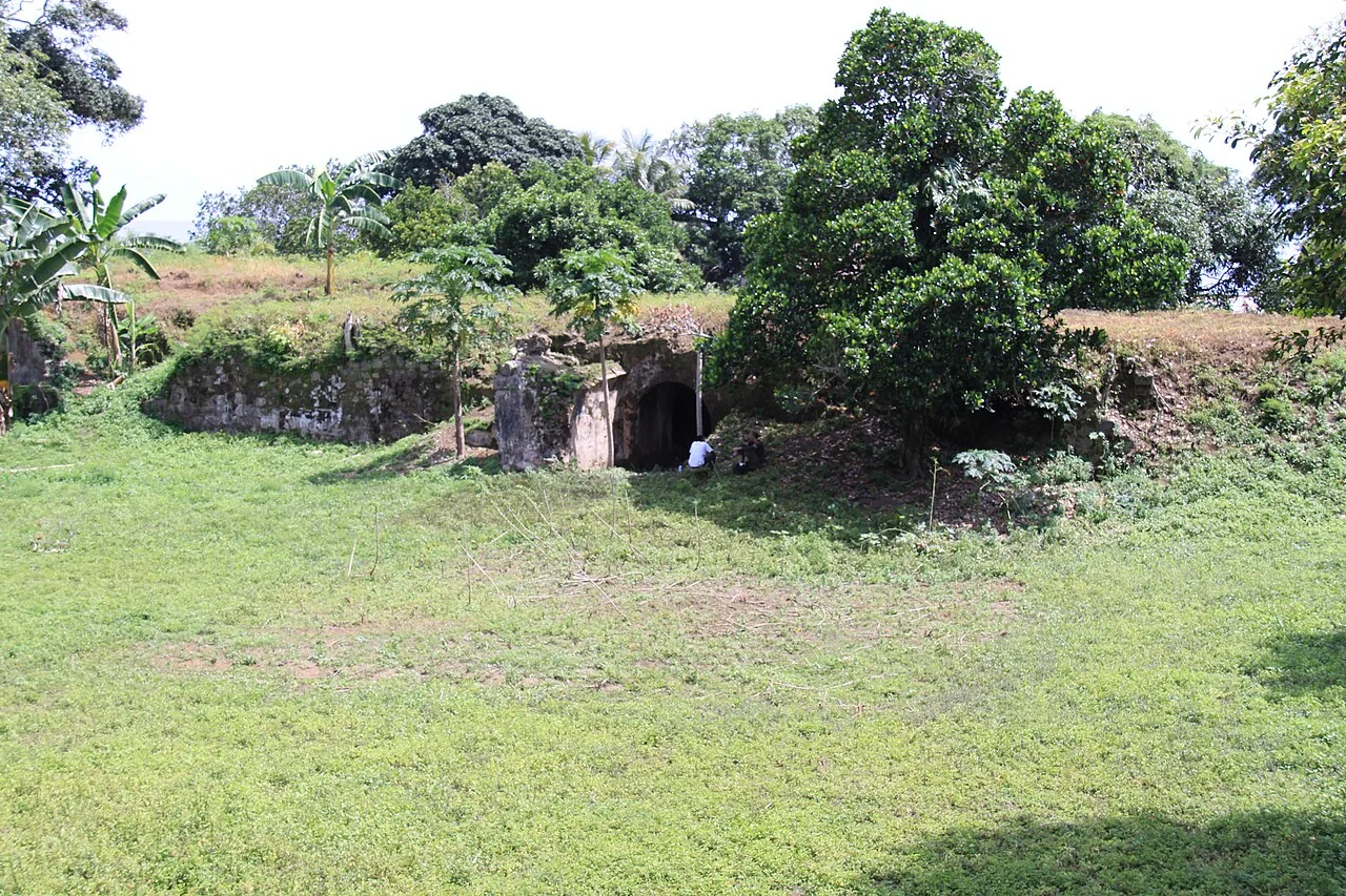
Low weathered stone walls and a dark arched entrance stand beside a grass clearing, with trees growing behind them.

05 Pulau Ai / Ay · the fort and the water

Ai: settlement and conquest

The fort on Ai was given the Dutch name Revenge. In 1615, Dutch troops had occupied the island before local resistance drove them out. Their fleet returned the next year. Ai's growers sold nutmeg to English buyers and other traders; the VOC wanted to end those dealings and make the islanders sell on its terms.

The 1616 capture brought deaths and forced people to flee. Crowded boats left at night, and people drowned during the crossing. When Dutch troops reached the last stronghold, defenders made their way down cliffs towards waiting boats; some fell to their deaths. The Dutch built their new fort over the defeated community's stronghold and stationed troops on an almost empty island.

People were brought in to replace those who had escaped. They included 450 from Siau, with their ruler, who had been tricked or forced aboard a Dutch ship and taken south. Poor treatment and shortages followed, and most soon escaped. Others brought to Ai came from Gujarat and Solor, along with Spanish prisoners of war.

Nutmeg plantations grew around the military post. In Muhammad Fadli's photographs of Ai, a gateway still bears the name Welvaren, Dutch for prosperity. People continued growing, gathering and processing the crop around the buildings left by company rule. Gardens and homes remained part of island life, across an exposed stretch of sea from Neira.

View on the map
Read more

Fort Revenge had five sides, with a bastion at each corner. The VOC's directors in the Netherlands objected to building another fort in Maluku, but the Council of the Indies went ahead. The bastions projected outwards so defenders could cover the walls from several directions. The enclosure occupied about 2,500 square metres, a large space on such a small island.

The garrison also needed drinking water. Rainfall was collected and filtered into cisterns inside the fort walls and beneath the raised earthwork behind them. Storing it was part of keeping the military post running, alongside defending its walls. With a reserve inside the fort, the soldiers did not have to depend on water being brought across from another island whenever they needed it.

An earthquake badly damaged the fort in 1683. Repairs followed, and the fort later became a prison for senior company officials and other high-ranking captives. It was restored again in 1753 and remained in use until the end of the eighteenth century. Old plans show the fort's defensive shape amid the plantations surrounding the military post.

Colonial lists eventually counted 31 nutmeg plantations on Ai. The island is made of uplifted limestone, flatter and drier than Banda's central volcanic islands. Nutmeg grew here as well as on those steep central slopes. Within the same small island, estate boundaries and fortifications marked out the land used for growing the export crop and the ground occupied by the military.

Muhammad Fadli crossed to Ai during the west monsoon in a boat about seven metres long. Waves came aboard, and frightened passengers prayed aloud. With a three-month-old daughter at home in Jakarta, he said he would never return. Later he came back with the writer Fatris MF. Their journeys took them through harvests, dry weather and storms, photographing on film and spending evenings talking with island residents.

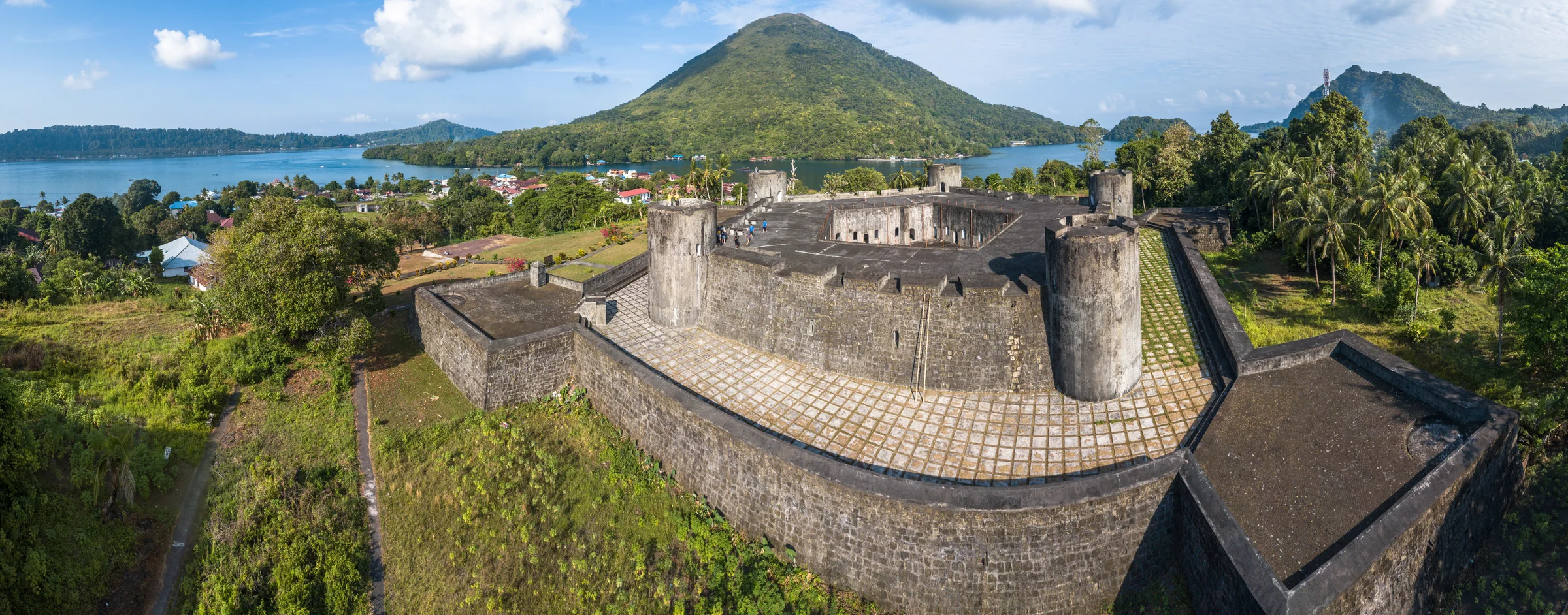
A wide view of a stone fort with round corner towers, roofs and palms below it, and a cone-shaped hill across the bay.
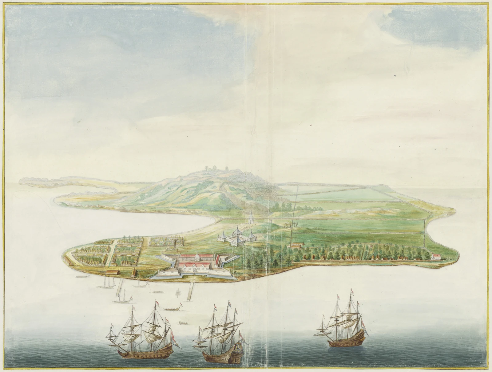
Bird’s-eye watercolour of an island with forts, houses and rectangular planted enclosures, with sailing ships and boats offshore.

06 Banda Neira · conquest and plantation labour

Banda Neira and the VOC

On 8 May 1621, Japanese soldiers working for the VOC executed 44 Bandanese orang kaya outside Fort Nassau. The men were community leaders from Lontor, across the narrow water from Neira. After interrogation, the company's new governor, Martinus Sonck, had convicted them of treason. One prisoner asked in Dutch whether there was no mercy. Then the executioner cut off his head.

Jan Pieterszoon Coen had arrived with a fleet to force Banda into a nutmeg monopoly. His troops took settlements, deported the inhabitants and hunted people sheltering in the hills. Others starved behind their defences. The killings, enslavement and expulsions destroyed much of Bandanese society. Historians now widely describe the campaign as genocide.

The nutmeg groves were divided into plots called perken. Private planters, known as perkeniers, had to sell their harvest to the VOC at prices the company set. The VOC supplied enslaved people to tend the trees and process the crop. Some were Bandanese survivors; others had been brought from elsewhere in Asia. Their forced labour kept the plantations producing.

Some Bandanese escaped by sea. Those who reached Seram organised resistance and sailed back to their former islands. Others settled farther east on Kei Besar. Their descendants in Banda Eli and Banda Elat have kept a distinct Bandanese language and stories of leaving their homeland. These communities stayed involved in the region's trade and politics.

View on the map

Banda is a lovely little spot, its three islands enclosing a secure harbour from whence no outlet is visible, and with water so transparent, that living corals and even the minutest objects are plainly seen on the volcanic sand at a depth of seven or eight fathoms. The ever smoking volcano rears its bare cone on one side, while the two larger islands are clothed with vegetation to the summit of the hills.

Alfred Russel Wallace, 1869
Read more

Fort Nassau's story began in 1609, when Admiral Pieter Verhoeff arrived with a heavily armed fleet and demanded permission to build. The orang kaya delayed their answer, but he sent men ashore and began work without consent. The islanders then invited him to negotiate and ambushed and killed him and his companions. His fleet attacked coastal settlements and boats in retaliation. An agreement was finally reached that August. By then, the fort was standing, with a permanent Dutch garrison on the land Verhoeff had entered without permission.

Fort Belgica occupied the high ground above Nassau and the harbour. Both forts appear in a painting made in Johannes Vingboons's workshop around 1662–1663. The VOC ordered it for the company's rooms in Amsterdam as part of a series showing its Asian posts. Neira's houses, shoreline and defences hung alongside views of other company settlements, some thousands of kilometres away.

The new planters needed people who knew the trees. Bandanese workers had the skills to tend and harvest them, and some deportees were brought back for that knowledge. Historians disagree about how much farming changed after the conquest. Older studies emphasised the creation of intensive plantations. S. J. Miske's work in the archives finds that much of the earlier cultivation continued, with little evidence of higher yields in the early years. Tall shade trees stayed in the groves. Planters struggled to find enough workers and food while meeting the company's demands.

On Banda Besar, Amy Jordan studied what plantation households left behind at three estates: Ordatang, Groot Waling and Komber. Pottery, animal bones and starch grains gave clues to their meals. People used imported dishes and found food through local resources and trade with other islands. What they ate varied from one estate to another and changed over time. Ordatang stood on a ridge along an old caldera, away from the beach, and was abandoned when Jordan excavated it. Many plantation buildings had been dismantled for materials or reused in later buildings.

A pile of red lacy strands lies beside dark oval seeds in a pale bowl on a woven surface.
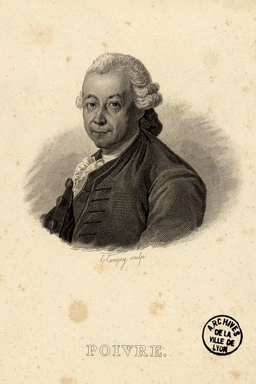
An engraved portrait shows a man with swept-back hair wearing a dark coat and a light neckcloth, with his name printed below.

07 Mauritius · the movement of living plants

Nutmeg beyond Banda

On 7 December 1778, witnesses gathered in the royal garden on Mauritius to watch Jean-Nicolas Céré pick a nutmeg. The tree had been planted eight years earlier. News of the harvest appeared in the island's newspaper, and officials were asked to send the nut to Louis XVI. Growing a single fruit had become a matter for the king.

Pierre Poivre, the island's intendant, had backed secret expeditions to collect plants in Maluku. Mauritius was then a French colony called Isle de France. A navy officer, Jean Mathieu Simon Provost, led the later voyages. Shipments arrived in 1770 and 1772. They followed years of plants dying, unreliable supplies and negotiations with people across the eastern archipelago.

Malay intermediaries and Maluku islanders helped the French get plants despite Dutch restrictions. Sailors then had to carry them across the Indian Ocean. On Mauritius, enslaved cultivators and gardeners worked to keep the plants alive in unfamiliar soil and weather. Instructions passed between officials, but much of the practical knowledge had to be shown, learned through work and adapted to the new conditions.

Plants also travelled west from Mauritius. On 3 February 1773, a shipment reached Cayenne in French Guiana after 64 days at sea. Later transfers carried nutmeg on to Caribbean gardens. Colonial gardens collected and passed on the trees. A crop once grown commercially around Banda was valuable enough for rival powers to keep trying to establish it elsewhere, despite the difficulties of each crossing.

View on the map
Read more

Getting a seed to grow after a long voyage was difficult. Nutmeg seeds quickly lost their ability to germinate, leaving little time to get them into the ground. Very few plants survived the early French shipments in the 1750s. In Pondicherry, a reward had already been offered for 25 living nutmeg plants. Buyers needed seeds or plants that would survive the journey and grow on arrival. The dried spice shipped to kitchens and pharmacies could not reliably start a new grove.

Poivre advised planting young trees beside bananas, which would protect them from wind and sun. His advice drew on observations made in Ambon and Banda, Rumphius's botanical work and Provost's collecting voyages. Identifying the imported plants took more work. Specimens were sent to Paris in glass containers filled with alcohol. Their labels carried Malay names, and French naturalists had to work out how those names fitted the classifications they used.

The name nutmeg was also used for other aromatic seeds. Monodora myristica, an African tree, supplied seeds called Jamaica nutmeg or calabash nutmeg. They reached the Caribbean with the slave trade. The pichurim nut, another substitute, came from a tree native to the Americas and reached Portugal in the eighteenth century. Plants with similar scents could end up with similar names in trade, even when they were unrelated. Botanical specimens helped separate these substitutes from the trees the colonial gardens were trying to grow.

After the Seven Years War, France considered sending spice plants to Guiana. Instructions to send nutmeg followed in 1771. In 1802, two specimens travelled from Cayenne to St Vincent, another link in a chain of gardens relying on one another's surviving plants. A specimen Julius von Rohr collected in Cayenne in 1784 later entered the British Museum herbarium. It carried male flowers from a cultivated tree about five years old.

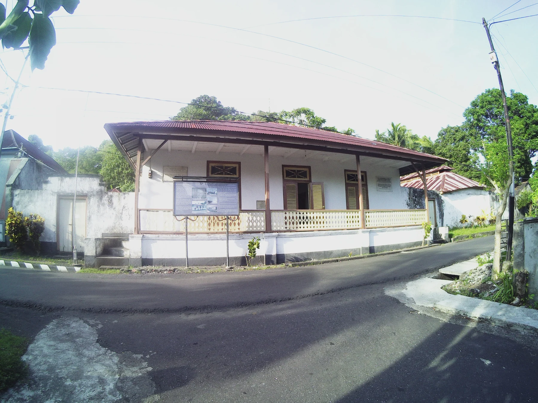
A single-storey white house has a broad red-brown roof, pale shutters and an open veranda facing a narrow paved street.
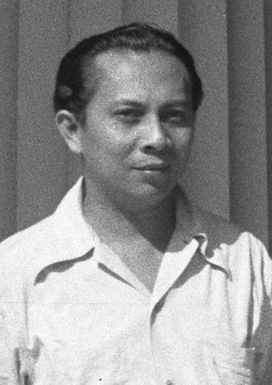
Black-and-white portrait of a man in a light, open-collared shirt.

08 Banda Neira · 1936–1942

Hatta and Sjahrir in exile

Before the Dutch deported him from Java, Mohammad Hatta packed his books into sixteen chests. He had been arrested in 1934 for nationalist activity and was being sent to Boven Digul in New Guinea. Reading and argument were central to his political life. He took his library into exile, and when he was moved to Banda, the books went too.

Hatta and Sutan Sjahrir arrived at Neira on the Fomalhaut on 11 February 1936. A crowd met them at the landing. They stayed first with Dr Tjipto Mangunkusumo, another nationalist in exile, then found a house of their own. They were still political prisoners, but in Banda they could meet local people more freely than they had in the Digul camp.

Afternoon lessons brought children to the back veranda. Hatta taught the older pupils, while Sjahrir worked with the younger ones. They studied reading, arithmetic and languages and talked about the world beyond Banda. One pupil, a local boy named Des Alwi, became part of Sjahrir's household. Through the school, the two exiles became familiar figures in the lives of island families.

In 1942, as Japanese forces advanced into the Netherlands Indies, Hatta and Sjahrir returned to Java. During the occupation, Hatta worked publicly alongside Sukarno; Sjahrir organised underground. After independence, Hatta became Indonesia's first vice-president and Sjahrir its first prime minister. The separate houses where they lived in exile still stand in Neira, in the town where they taught.

View on the map
Read more

Sjahrir kept in touch with Maria Duchâteau in the Netherlands by letter. He spent his Banda years apart from her, growing flowers, making friends and following political events. The letters later became Out of Exile. Both men ordered books from Batavia and Europe and wrote articles for publication. They read German philosophy, French literature and European politics, continuing their studies while the colonial authorities kept them far from the political organisations they had helped to lead.

Hatta liked a strict routine and expected his pupils to work carefully. Sjahrir spent more time playing and talking with children, using their interests as a way into a lesson. The families around them knew their different habits well. To Des, they were Uncle Hatta and Uncle Rir. They became part of family life in Banda, even as the authorities kept them out of national politics.

At Iwa Kusumasumantri's house, they met Bahlawan, a Bandanese Arab teacher. He taught Arabic history to Hatta, Sjahrir, Iwa and Tjipto; Iwa also studied the Qur'an and Islamic history with him. Learning in exile included these conversations with people who already lived in Banda. Hatta began each day by bathing and praying, followed by coffee and reading before breakfast. Sjahrir's less formal religious habits gave the two men something to tease each other about. They worked together despite their very different daily routines.

Decades later, Suharto's government sent political prisoners to Buru, west of Ambon. Pramoedya Ananta Toer spent ten years there. Prisoners cleared land, cut roads and built their own barracks. During his imprisonment, he composed the novels that became the Buru Quartet. This Earth of Mankind was published in 1980, after his release, and was banned in Indonesia the following year. Child of All Nations, Footsteps and Glass House followed, each facing censorship. Pramoedya continued publishing with Joesoef Isak and Hasyim Rachmat, two men who had also been prisoners.

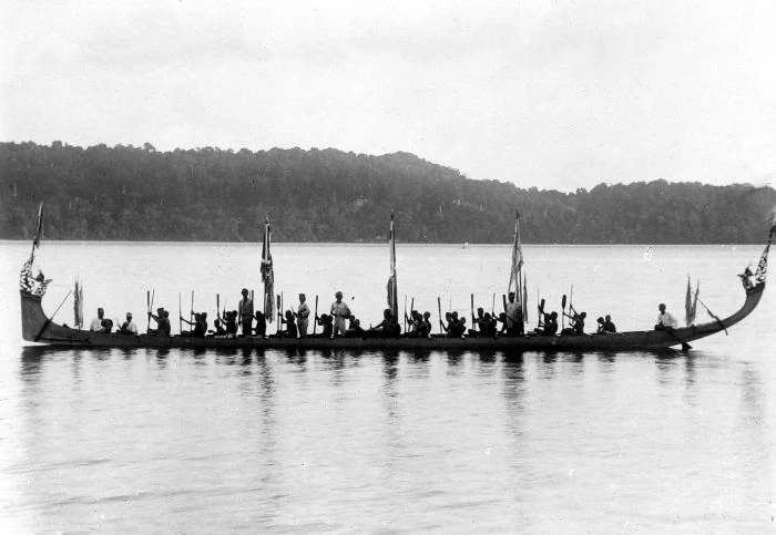
A black-and-white photograph shows a long boat with many seated people, paddles, several flags, and high curved ends against a wooded coast.
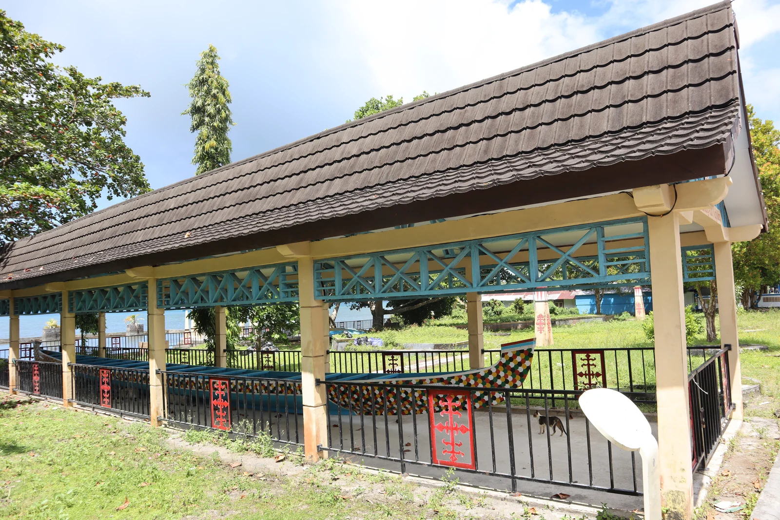
A long painted wooden boat rests inside an open pavilion with a tiled roof.

09 Banda · boats, songs and customary authority

Belang, kabata and Mama Lima

On a decorated belang, paddlers sing kabata as they compete against crews from other villages. The songs tell of voyages, places and events passed down within each community. Also known as kora-kora, these boats carry carved and painted decorations and take part in ceremonies shaped by sea journeys and island livelihoods.

Preparations start on land. People honour sacred places called keramat and hold ceremonies at the rumah adat, the traditional house. Special bamboo poles are used in the cakelele warrior dance. The occasion brings together people with different tasks: gathering materials, preparing the rituals, singing, dancing and handling the boats. Those who work behind the scenes have responsibilities alongside the performers.

Mama Lima are groups of five women who hold customary knowledge and teach it to the next generation. They decide what happens in ceremonies such as Buka kampong and how each part should be performed. Their authority also covers how people live together, care for one another, practise religion and relate to the natural world. Younger women learn by taking part and carrying out their community's duties.

In Lonthoir and Selamon, adat, or customary practice, includes Muslim prayer. Imams take part, passages from the Qur'an are read and incense is burned. Sacred founding figures known as datu connect communities to particular places. Families with different origins share these customs. Their sense of belonging grows through duties to the place and to one another, as well as through the stories of where their families came from.

View on the map
Read more

Anthropologist Phillip Winn once asked a ritual leader in Lonthoir how adat and religion fitted together. The man hooked his index fingers together and pulled: he could not separate them. A healer in Selamon showed Winn the same gesture. On another ceremonial morning, Muslim songs came from a mosque loudspeaker. A neighbour spoke of the celebration as an Islamic feast. For the people Winn spoke with, carrying out customary duties was part of religious life in the negeri, a word that includes both the community and its territory.

In 1922, Saleh Neirabatij of Lonthoir wrote a hikayat in Malay, with drawings of ships and verses to be recited aloud. Local heroes, including Cilu Bintang, lead its story. The manuscript became part of the National Maritime Museum's collection in Amsterdam, though researchers later thought it had been lost. Curator Diederick Wildeman recognised it there in the 1990s. Its old Malay text was transcribed and an English summary prepared. Plans were made to send facsimiles to institutions in Banda and Ambon.

A fight at Ambon's transport terminal in January 1999 grew into attacks between Christian and Muslim groups. Mobs burned houses and places of worship. Civilians were killed or forced from their neighbourhoods, and the fighting spread to other islands. Soldiers and police sometimes stood aside; at other times they fired on civilians or joined the attacks. Rumours prompted reprisals before anyone could check what had happened. Behind the violence lay political and economic tensions that had worsened after Suharto's government collapsed.

In 2000, Laskar Jihad brought armed fighters into Maluku from outside the islands. Christian militias were also fighting. Automatic weapons were now being used alongside homemade guns and bombs, while families fled districts increasingly divided by religion. Muslim and Christian delegates signed the Malino II agreement on 12 February 2002. The agreement helped turn the conflict towards peace, but attacks continued and serious violence returned in 2004. Estimates of the toll differ: several thousand people were killed and hundreds of thousands driven from their homes.

In Wayame, Muslims and Christians organised joint night watches and set up a team to check rumours before people acted on them. Women worked to keep their shared market open. In other places, neighbours began visiting one another again for funerals, weddings and religious holidays. Local leaders negotiated safe places to trade. These efforts began while the fighting was still going on and continued after the peace agreement, helping families live alongside neighbours from whom the violence had separated them.

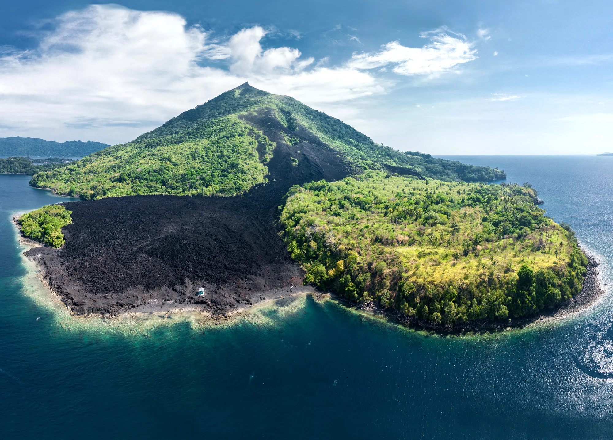
Aerial view of a cone-shaped hill with green vegetation and a broad dark band of bare ground extending to a curved shoreline.
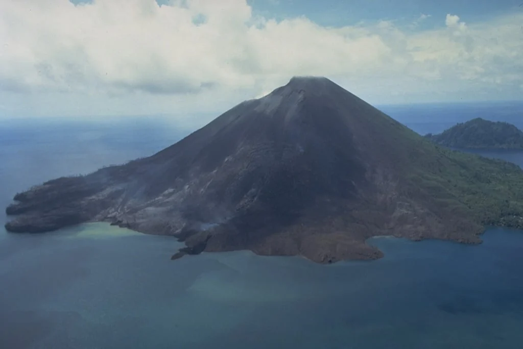
Aerial view of a largely bare volcanic cone, with dark rock extending down to blue water.

10

Banda Api’s 1988 eruption

On the morning of 9 May 1988, lava ran down Banda Api and into the sea. At Batu Angus, on the northern flank, it reached the water before midday. Another flow came down the northwest side at Pasir Besar, and a smaller one reached the south coast. Between the northern vents, the ground sank and openings hundreds of metres apart joined together.

Three people died. Two were killed in a boat accident during the evacuation. By late May, more than 7,000 residents of Gunung Api, Neira and Lontar had been taken to Ambon. People from Neira and Lontar were allowed home in June. Those whose homes were on Banda Api remained displaced.

Five years later, researchers found 124 coral species on a sheltered lava flow. Living coral covered an average of 61.6 per cent of the area they surveyed. Table-shaped Acropora colonies dominated parts of the reef, some more than 90 centimetres across. The lava flow supported a richer, denser coral community than the nearby limestone reef it had missed.

A coral colony is a group of tiny animals called polyps. Each has a mouth and tentacles and builds a skeleton of calcium carbonate, attached to rock or older coral. Many reef-building corals have microscopic partners in their tissues that use sunlight to make food. The polyps also catch food from the water. Together they build the reef’s branches, plates and rounded structures.

View on the map
Read more

Before the eruption, earthquakes became more frequent. In Neira, about two kilometres east of the summit, people felt them every few minutes between 8 and 10 May. The eruption began at 6.30 in the morning. Columns of ash and gas rose three to five kilometres above the vents. On that first day, explosions came from opposite sides of the volcano, more than a kilometre apart.

At about 11.30, the eruption column on the south side bent towards western Lontar. Ash and rock fragments swept across the island’s western end in a blast that lasted less than a minute. Activity later moved towards Banda Api’s summit. Lava kept moving on the north side for several days, while the explosions grew weaker. By 18 May, all the craters were quiet.

The cooled andesite lava gave corals a firm, uneven surface to settle on. Tomascik, van Woesik and Mah compared it with an older limestone reef and loose volcanic deposits off the southwest coast. They suggested that crevices protected young corals from predators, and that larvae arrived from nearby and more distant reefs. Loose deposits shifted, making it harder for corals to attach and grow.

On some evenings in Banda, corals release bundles of eggs and sperm into the sea. Researchers watching between 2016 and 2019 found spawning peaks in April and October–November. Releases commonly came five to seven days after the full moon, two to three hours after sunset, on a falling tide. The team watched directly and used traps to catch floating eggs. Rising water temperature and the moon also helped set the timing.

The egg traps were made from household funnels and plastic bottles. Divers placed an inverted funnel over a coral colony, with a bottle above to catch bundles as they floated up. A little air kept the bottle upright, and nylon ties held it to the coral or nearby rock. The traps could catch a spawning release when no divers were present. Eggs collected the next morning went for DNA analysis to help identify which corals had spawned.

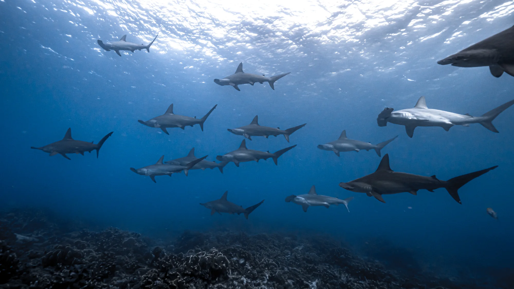
Several sharks, some with broad T-shaped heads, swim above a dark reef beneath bright, rippled surface water.

11

Hammerheads in the Banda Sea

A scalloped hammerhead takes its name from the shape of its head: a broad curve with a notch in the centre and smaller indentations to either side. Those scallops help identify Sphyrna lewini. Behind the head is a slender body with a tall first dorsal fin. An arched mouth sits underneath, and its brownish-grey or bronze back fades to a pale belly.

The reefs, pinnacles and deep slopes around Hatta, Rhun, Ai and Suanggi are gathering places for scalloped hammerheads. They form the Banda Islands Important Shark and Ray Area, recognised by the IUCN Shark Specialist Group. Larger groups are reported from mid-September to early December; smaller groups have been reported throughout the year. The area follows the islands’ underwater slopes from the surface into deep water.

Young scalloped hammerheads use shallow coastal nursery areas. As adults, they range offshore, moving between coastal shelves, island edges and the open ocean. They eat fish and crustaceans, squid and octopus, as well as other sharks and rays. The species lives across warm seas, including the Indo-Pacific.

Scalloped hammerheads are caught for meat and fins, both deliberately and as bycatch. Inshore fishing reaches the young in their coastal nurseries. When sharks gather in a school, a single fishing operation can catch many at once. The species is listed as Critically Endangered.

View on the map
Read more

The seasonal pattern in the 2024 Banda assessment comes from local sightings, divers’ observations and work by Indonesian conservation researchers. The evidence includes personal communications, published research and unpublished monitoring. It shows that sharks return to particular waters. The assessment calls these “undefined aggregations”, meaning the purpose of the gatherings hasn’t been established. Observers have not shown whether these are feeding, mating or resting groups.

Tiny pores underneath the head allow a hammerhead to sense weak electrical fields, including those produced by a prey animal’s muscles. As it swims, the broad head carries these sensors across a wide area, helping it find animals in the water or on the seabed. Waldiney Mello studied four hammerhead species from the southwest Atlantic. Each had its own arrangement of pores, a pattern that can also help identify the species.

Tags attached to scalloped hammerheads in Hawai‘i showed them swimming down into water close to five degrees Celsius. Their muscles stayed warm during the dive, then cooled quickly as they rose. The researchers linked this temperature pattern to the sharks closing their gill slits and reducing heat loss through the gills. Video taken more than a kilometre deep showed the slits tightly closed. The sharks stayed at the deepest part for only a few minutes before heading back towards warmer water.

Pacific water reaches Banda through a network of Indonesian passages. One deeper eastern route comes through Lifamatola Strait, then the Seram and Banda seas. Farther south, Timor Passage and Ombai Strait carry water out of the Banda basin towards the Indian Ocean. Along the way, narrow passages and submerged sills stir the water, changing its temperature and salt content as different waters mix.

A buoy secured to the seabed gives a boat somewhere to tie up without dropping an anchor onto coral. In April 2025, crews installed moorings at six sites around Rhun, Manukang and Hatta. Village representatives, university staff, conservation workers and fisheries officers helped choose the sites and put the equipment in place. Hatta’s village leader, Sudar Raharusun, offered the community’s help with looking after the moorings.

Chronology

Across the centuries

  1. c. 5750 BCEEarly occupation on Ai
  2. c. 1500 BCENutmeg in a cooking pot
  3. 1304Banda named in a Chinese text
  4. 1602The VOC is founded
  5. 1605Hitu and the Dutch alliance
  6. 1616Ai is conquered
  7. 1621The conquest of Banda
  8. 1623The Amboyna trial
  9. 1667The Treaty of Breda
  10. 1770–1772Plants reach Mauritius
  11. 1778Céré’s witnessed harvest
  12. 1936–1942Hatta and Sjahrir in exile
  13. 1988Banda Api erupts
  14. 1999–2002The Maluku conflict
  15. 2025Community moorings

Reading room

Explore further

Research collection

Original papers

Archaeology and food

Spice Island Stew

Archaeological evidence for food and everyday life on colonial nutmeg plantations on Banda Besar.

49 min · PDF

Alfred Russel Wallace · 1869

The Malay Archipelago

Fifteen complete chapters from Banda, Ambon, the Moluccas, Kei and Aru.

The stories, map and reading room can be saved on this device. External articles need internet unless labelled otherwise.