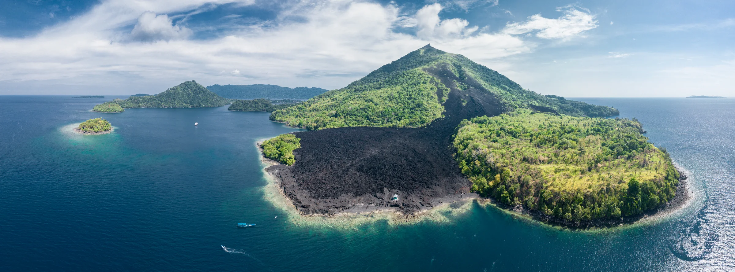
Aerial panorama of a cone-shaped island with green slopes, a broad dark strip of bare ground reaching the shoreline, and small boats offshore.

Rascal Voyages · Maluku, Indonesia

The Spice
Islands

Ambon & the Banda Sea

↓Photo details

Island atlas

Explore the islands

Batu Kapal and the surrounding reefs

Batu Kapal is a small rocky islet northeast of Neira. Reef-fish surveys distinguish dives on its southeast and northwest sides, giving two views of underwater life around the same rock.

Banda reef-fish observations

The stories

Welcome aboard

During our time in Ambon and Banda, we’ll be spending much of the voyage in and around the water. I’d also like to introduce you to the people who made their homes on these islands, the visitors who arrived looking for spices, and the events that brought them together. Knowing something of that history gives us more to notice when we go ashore, whether we’re walking beneath nutmeg trees or looking across a harbour from the walls of a fort.

We’ve put this information pack together for you to enjoy during the voyage. There is a story running through it, beginning with the earliest island communities and following the growth of trade, the struggle to control it, and the lives of the people caught up in that struggle. Alongside the stories, you’ll find longer articles and original accounts whenever something catches your curiosity. Take your time with them; there will be plenty to talk about together on board.

Choose a chapter
  1. 01 Maluku before the Europeans
  2. 02 Nutmeg and mace
  3. 03 Ambon: cloves and coastal kingdoms
  4. 04 Rhun and the Treaty of Breda
  5. 05 Ai: settlement and conquest
  6. 06 Banda Neira and the VOC
  7. 07 Nutmeg beyond Banda
  8. 08 Hatta and Sjahrir in exile
  9. 09 Belang, kabata and Mama Lima
  10. 10 Banda Api’s 1988 eruption
  11. 11 Hammerheads in the Banda Sea
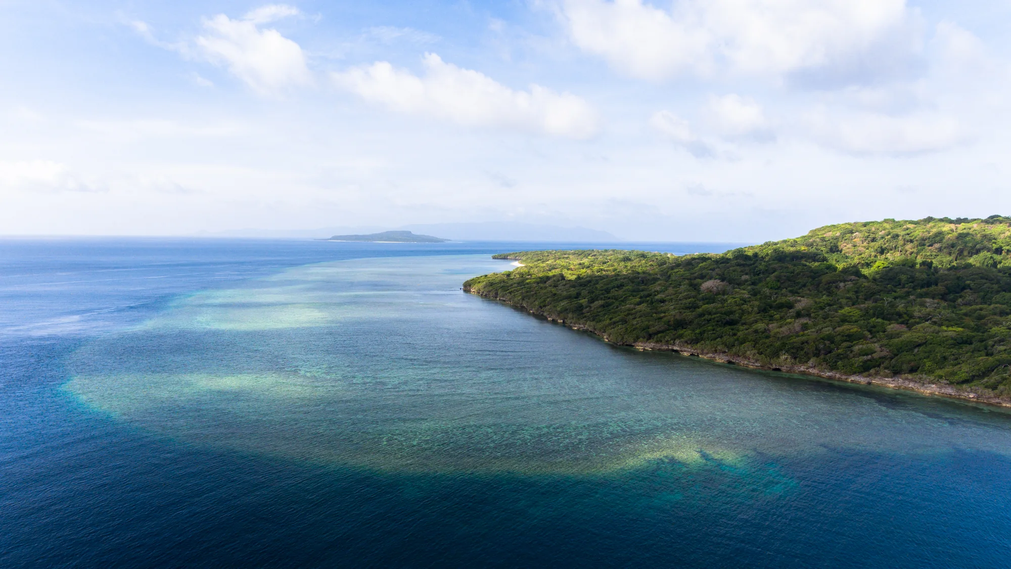
A forested coastline curves beside bands of pale turquoise water and deeper blue sea, with low islands on the horizon.
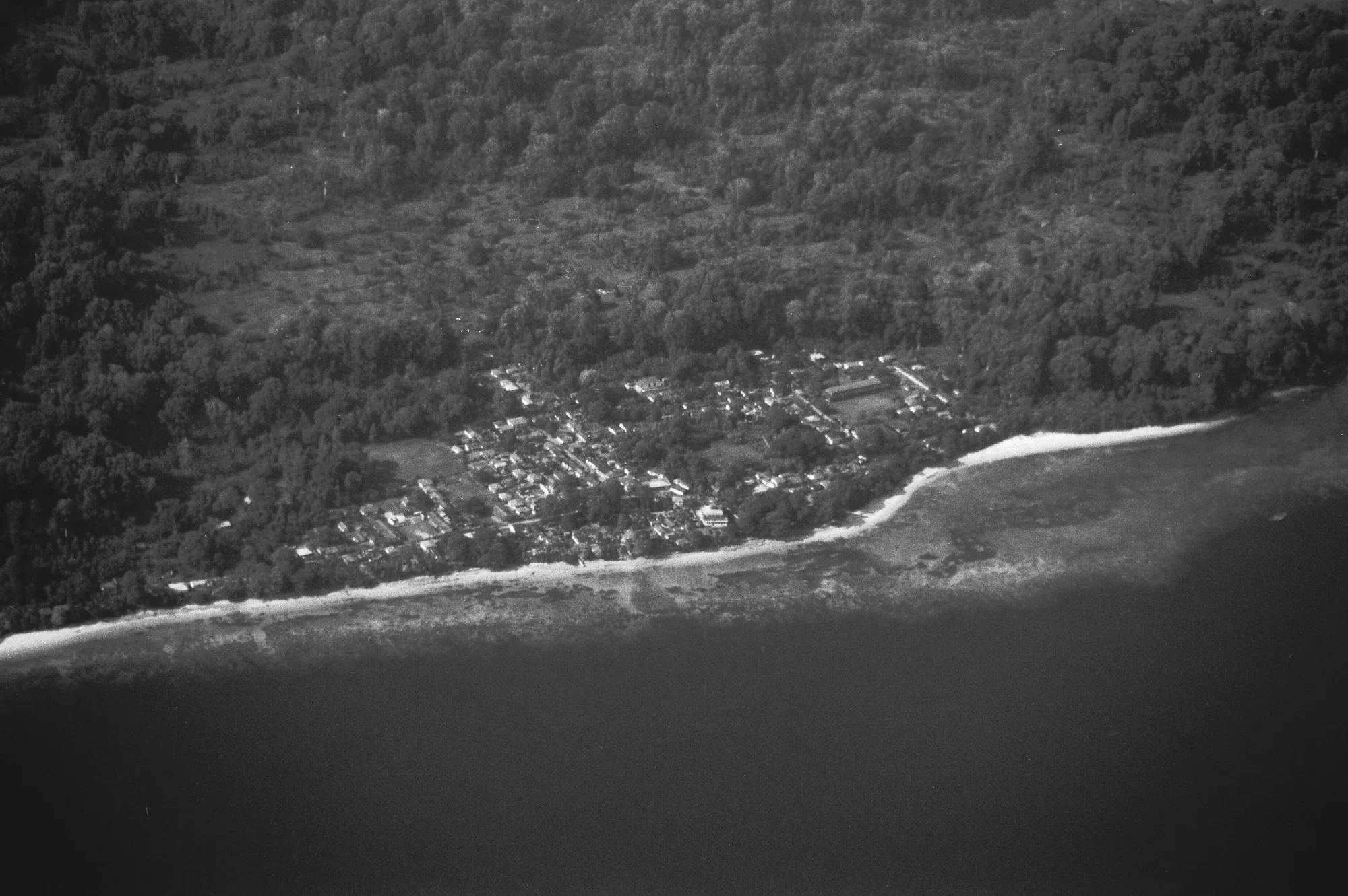
A monochrome aerial photograph shows a tree-covered coastline, clustered roofs, a pale beach and dark water.

01 Pulau Ai · food, voyages and belief

Maluku before the Europeans

I’d like to begin with something very ordinary: a cooking pot. About 3,500 years ago, someone on Pulau Ai was using nutmeg to prepare food. Tiny traces survived on pottery buried in the ground, where archaeologist Peter Lape and his colleagues also found residues of sago and purple yam. People were bringing these ingredients into their homes and preparing meals with them thousands of years before Europeans sailed here to buy Banda’s spices.

Those cooks were not the first people to reach Ai. A rock shelter elsewhere on the island contains evidence of visits dating to roughly 5800–5600 BCE, long before the pottery settlement. The early visitors appear to have come for the reefs and their fish, returning across the sea rather than making permanent homes on an island with little fresh water. Banda was never joined to the Asian or Australian mainland by a land bridge, even when sea levels were lower. Whoever first reached its shores had already made an open-water crossing.

Elsewhere in Maluku, people had been making such journeys much earlier. In Golo Cave on Gebe, far to the north of Banda, worked stone and shell survive in deposits about 35,000–36,000 years old. Later inhabitants shaped shell into adzes with ground cutting edges and worked bone into tools. By roughly 3,000–3,300 years ago, people at Uattamdi on Kayoa were using pottery with a red coating and wearing shell ornaments. These were separate island communities, each learning how to use what its shores and forests provided, and bringing new materials and skills from across the water.

Making a home on Ai required people to solve a practical problem. There was fish in the surrounding sea, but no permanent rivers to supply drinking water. Some of the earliest pots had thin walls and shapes suited to holding liquids, which would have helped people keep water available. Later pottery was thicker and better suited to cooking. Alongside it were fish bones, stone tools and holes where wooden posts had stood, suggesting that people were building houses as they adapted to life on the island.

Their meals changed as well. Fish dominated the earliest food remains, while domestic pigs became more important over the following centuries. Ai had no native land mammals, so the pigs had to arrive by boat. The pottery was changing too: many early pots had a red coating, and some pieces carried patterns cut or pressed into the clay. Small stone scrapers and flakes lay among the broken vessels. The work of making tools, preparing food and keeping animals was becoming established on land where earlier visitors had stopped to fish.

That early settlement was largely or entirely abandoned around 2,300 years ago. Many centuries separate its households from the towns that later grew around the spice trade. By then, the arrivals included Chinese ceramics as well as the food and tools needed for everyday life. A bowl could pass through several ports and several merchants’ hands before reaching Banda; finding one here does not mean a Chinese ship had carried it all the way. Written references become clearer in the fourteenth century: the Chinese Dade Nanhai zhi names Banda in 1304, and the Javanese poem Desawarnana names it in 1365.

Cargo coming from nearby islands was just as necessary as these distant goods. As more land and labour went into nutmeg, Banda relied increasingly on food brought by sea. East Seram, Seram Laut and Gorom were among the places supplying sago, the starch that formed a staple of island meals. The network also reached Kei and Aru, while rice came from Java and Bali. People arriving with food could buy cloth, metal goods and other imports in Banda. Across these routes, the growers’ harvest helped pay for the supplies their households needed throughout the year.

People and beliefs moved through these connections too. Lape followed the spread of Islam by comparing food remains from 21 sites on three islands with old maps and descriptions of named villages. In one settlement, pig bones were absent from around 1200; in another, only about a kilometre away, people continued eating pork well into the sixteenth century. The contrast mattered because avoiding pork was an important public expression of Muslim identity. When he returned to the written accounts, he found another difference: leaders of the pork-eating settlement lacked the Muslim title imam used elsewhere. Taken together, the evidence points to communities adopting Islam at different times.

Burial customs differed as well. Burned human remains, ash and decorated pottery at one settlement suggest that cremation continued there while Muslim communities were growing nearby. By the time European ships arrived, Banda’s towns already had growers tending trees, merchants negotiating over cargoes and leaders managing their own alliances.
View on the map
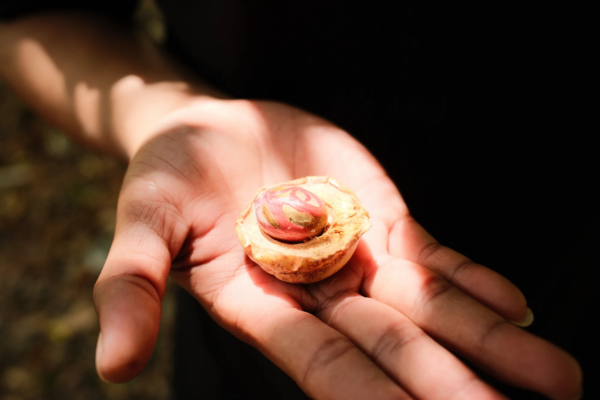
An open hand holds a cut yellow-brown fruit, showing red strands surrounding a dark central seed.
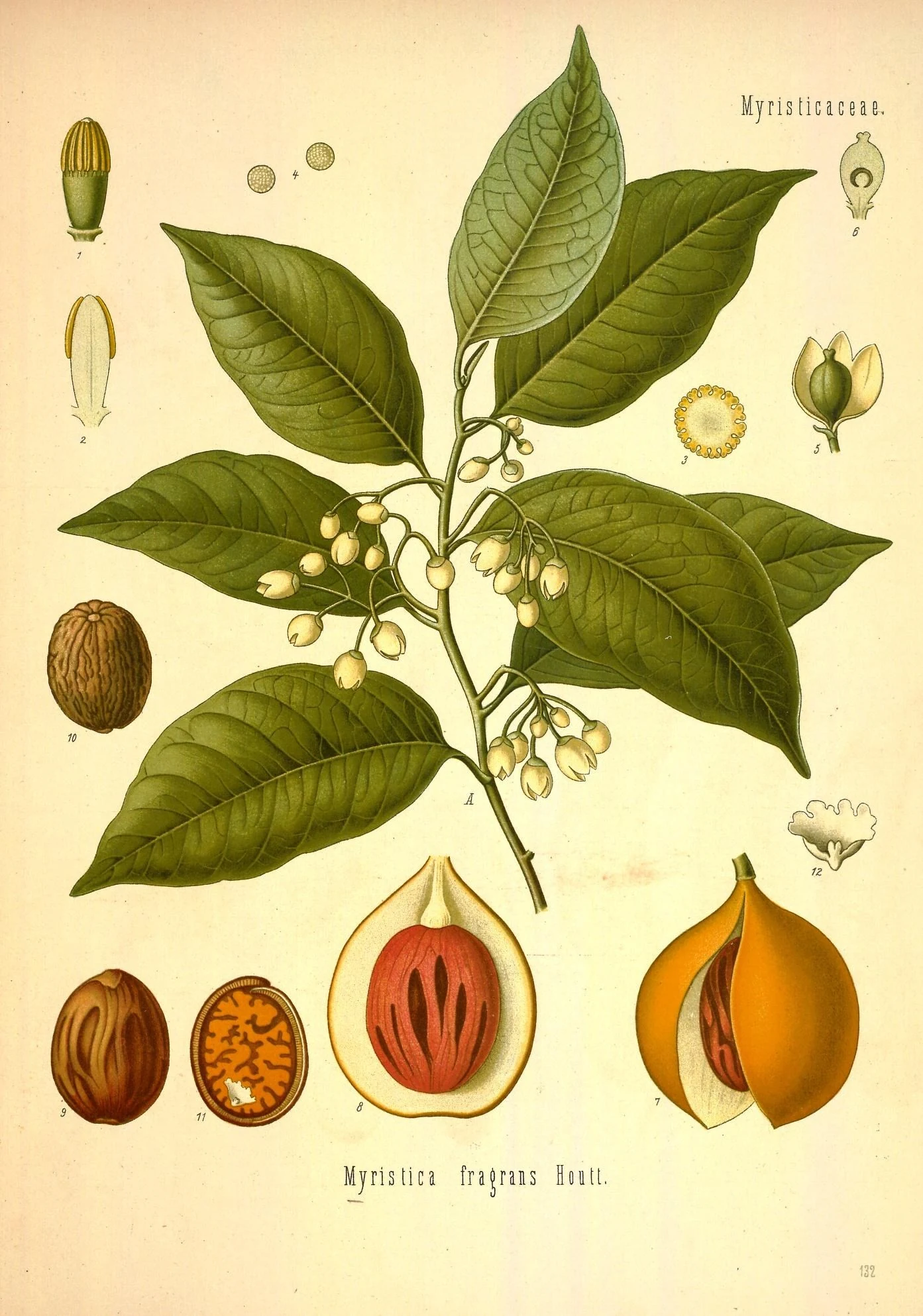
Colour botanical plate with a leafy branch, small flowers and numbered drawings of split fruit, seeds and flower parts.

02 The fruit and the work of cultivation

Nutmeg and mace

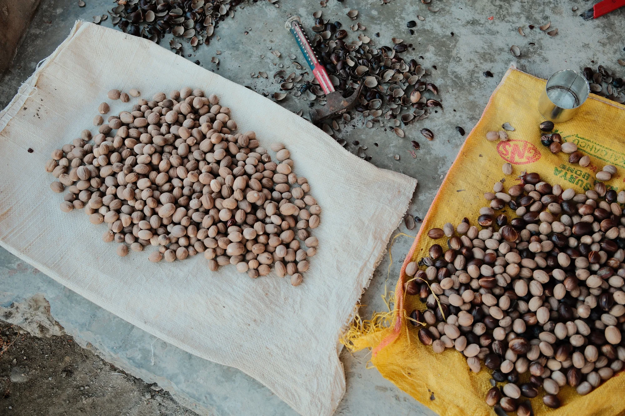
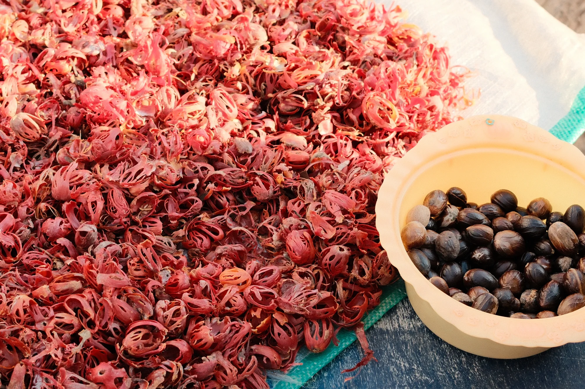
When you see a whole nutmeg fruit, it takes a moment to connect it with the spice we use in cooking. The fruit has a rounded, yellowish outer skin, and when it ripens it splits open to reveal a bright red, lacy covering around a dark shell. That red covering is mace. Inside the shell is the kernel that becomes nutmeg. Both spices begin here, in a fruit that has to be grown, gathered and carefully taken apart before a merchant has anything ready to carry away.

For a grower, the work begins years before that fruit appears. A nutmeg tree raised from seed takes several years to flower, and its sex generally becomes clear only then. Most trees are either male or female, and a grove needs both for pollination and fruit production. A healthy young tree may therefore grow for years without its owner knowing whether it will eventually bear fruit. Establishing a grove involves keeping enough male trees to pollinate the females that produce the harvest.

In a grove, the fruit is easier to notice than the flowers that came before it. The small, pale flowers hang beneath glossy leaves, whose undersides are lighter than their upper surfaces. The trees can grow among taller neighbours in partial shade, but they need moisture and soil that drains well. Beneath the ground, feeding roots spread close to the surface, making the trees vulnerable to strong winds.

Once a female tree has flowered and been pollinated, its fruit develops over several months. Beneath the evergreen leaves, the outer skin gradually changes colour and begins to open. That split gives the harvester a visible sign that it is ripe. In Banda, a long pole fitted with a blade and a small basket allows a picker to reach fruit high in the branches and catch it as it comes away from the tree.

Once gathered, the fleshy outer part is removed and the soft mace is peeled away from the shell. There is useful food in the flesh as well: nutmeg fruit can be made into preserves. The spice harvest is now divided into the delicate mace, ready to be laid out to dry, and the nutmeg kernel, still protected by its hard shell. Mace loses its vivid red colour as it dries, turning towards orange or yellow, while the kernel remains inside its shell as moisture slowly leaves it.

Drying the nutmeg takes weeks. As it shrinks, the kernel becomes loose enough to rattle when the shell is shaken. Moisture left in the crop, or rain reaching it during processing, can lead to mould, so a fruit successfully brought down from the tree can still be lost before it is ready for sale. Only after drying can the shell be cracked and the kernels sorted. By the time a merchant is choosing a cargo, years have gone into establishing the trees, months into growing the fruit and weeks into preparing the spices.

Long before Portuguese vessels reached Banda, nutmeg was known in China and the Arab world, where it was used in food and medicine. European scholars still repeated mistaken ideas about the living tree. A specimen from the first Dutch expedition to Banda reached the botanist Carolus Clusius in Leiden, allowing him to examine the plant for himself.

Clusius published his description in 1605. The preserved branch allowed him to correct claims that the nutmeg tree produced cloves as its flowers, or that mace itself was the blossom. Beside the text he placed an illustration of the specimen, with a fruit hanging from the end of the shoot.

View on the map

The most remarkable is a fine and very handsome fruit-pigeon, Carpophaga concinna, which feeds upon the nutmegs, or rather on the mace, and whose loud booming note is to be continually heard. This bird is found in the Ke and Matabello islands as well as Banda, but not in Ceram or any of the larger islands, which are inhabited by allied but very distinct species.

Alfred Russel Wallace, 1869
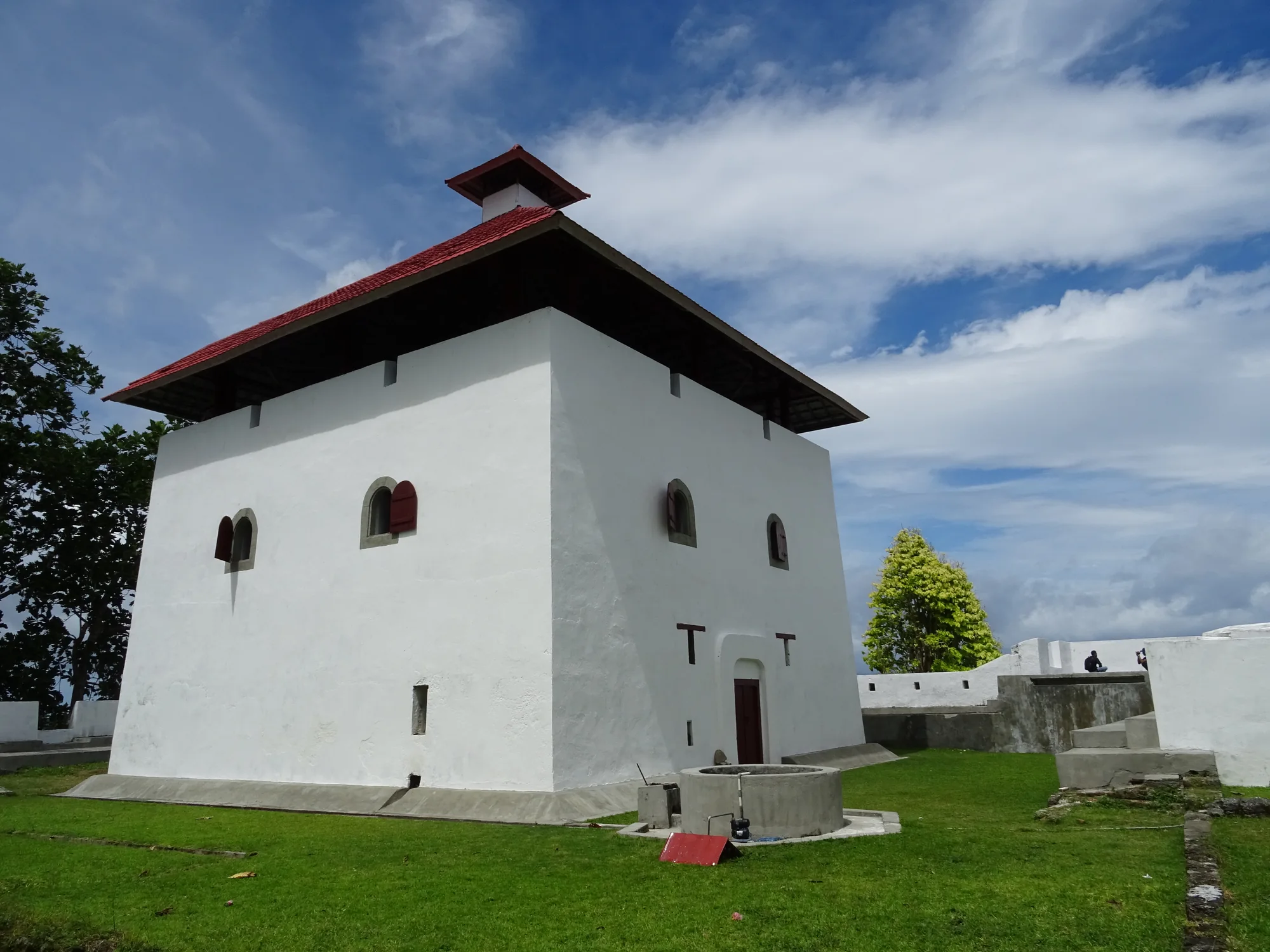
A pale masonry building with a steep red roof and low stone walls stands beside a grassy path and trees.
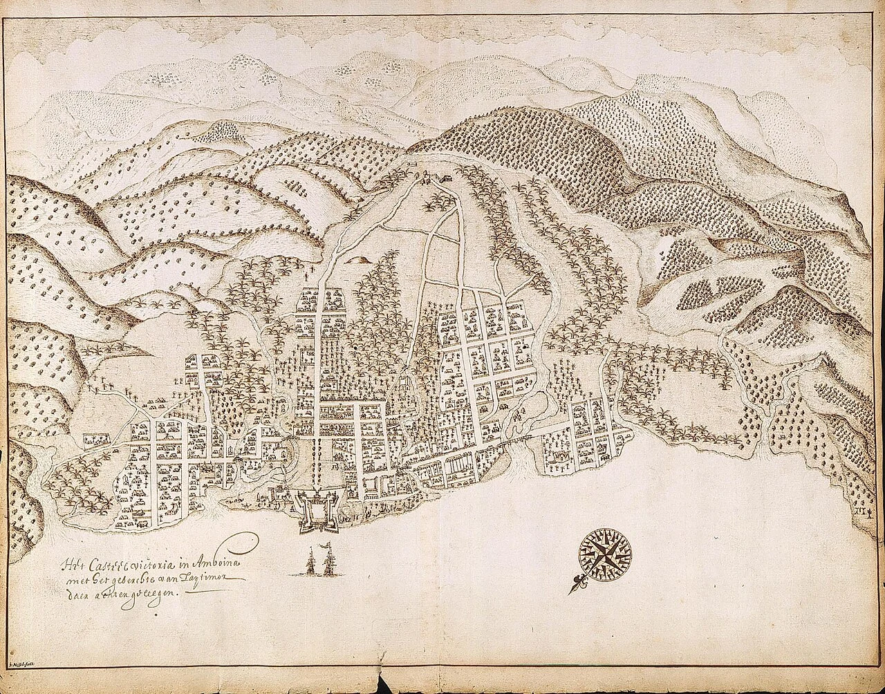
A historic pen drawing shows a coastal town, a walled fort, trees and hills, with a compass rose and handwritten labels.

03 Ambon · Hitu and the clove ports

Ambon: cloves and coastal kingdoms

Cloves drew foreign traders to Ambon, but the Portuguese arrival began with local fishermen finding sailors who needed help. The Hituese imam Rijali tells how they brought the strangers to Jamilu, one of Hitu’s leaders. Their ship had struck a reef, and they had escaped in a smaller boat. They said they had come from Portugal to trade. Jamilu allowed them to stay and establish a house. Rijali wrote this history more than a century later, during his exile in Makassar between 1647 and 1653. His Hikayat Tanah Hitu was written in Malay using Jawi, a script based on Arabic.

Ships returned with the west monsoon, bringing cloth for Jamilu and trade to the market. Rijali then tells of Portuguese men getting drunk and plundering it. A religious leader wanted them executed, but Hitu’s four leaders spared them and arranged for them to move elsewhere. Their decision turned partly on Hitu’s reputation and its treatment of guests. In this account, the men arriving from Europe depended on local rulers who could decide whether they were welcome to remain.

The cloves they wanted came from a trading world that stretched far beyond Ambon. Farther north, the small volcanic islands of Ternate, Tidore, Moti, Makian and Bacan had been at the heart of clove cultivation. The sultans of Ternate and Tidore built wealth and alliances through that trade, and their influence reached neighbouring islands and ports. On Ambon, growing demand for cloves drew Hitu’s rulers into dealings with these northern powers as well as merchants arriving from the west.

Over the decades that followed, relations between Hitu and the Portuguese deteriorated into repeated fighting. In 1576, the Portuguese built a stronghold on Ambon Bay; around 1580, it was replaced by a better fort nearer the shore, with four bastions. This later settlement stood across the bay from Hitu, on Leitimor. Its walls gave the Portuguese a base they could hold even when neighbouring rulers opposed them, while Hitu’s leaders began looking for an ally who could help drive them out.

By the beginning of the seventeenth century, the Dutch offered that possibility. Their East India Company, the VOC, had been founded in 1602 with powers that went well beyond buying and selling: it could make treaties, wage war and hold territory. Merchants operating through the company could call on ships and soldiers to defend their interests and attack competitors. For Hitu’s rulers, who wanted the Portuguese expelled, that military strength offered a way to remove an opponent.

In 1605, Hitu formed an alliance with the company and invited the Dutch to act. On 23 February, the Portuguese surrendered their fort to the VOC admiral Steven van der Hagen without a shot being fired. The Dutch renamed it Victoria, and it became the seat of their first territorial administration in the East Indies. Hitu had secured the removal of its opponent, while the company had gained a fortified base from which to govern and trade.

The agreement required Hitu’s cloves to be sold exclusively to the VOC, and a fixed price followed shortly afterwards. For a grower or merchant covered by those terms, another buyer’s better offer could no longer be accepted without breaking the agreement. The Dutch sought similar advantages farther north. In 1607, they built a fort on Ternate to support its sultan against Spanish forces coming from the Philippines, claiming the right to buy his territories’ cloves in return.

The trial at Fort Victoria

Inside Victoria, the company’s soldiers had arrived through networks as far-reaching as its trade. Among them was Shichizō, a 24-year-old mercenary from Hirado in Japan. His appearance on the fort’s walls in February 1623 set off interrogations that widened into an accusation that Japanese soldiers and English merchants were plotting to seize the castle. The English were commercial rivals, while the Japanese men served in the Dutch garrison itself. Officials brought both groups into a trial that would last only fifteen days.

Interrogators forced confessions using water torture. A prisoner’s arms were bound to a door frame, cloth was tied over his face, and water was poured over his head until he could not breathe. The advocate-fiscal, Isaaq de Bruyn, directed the prosecution. Dutch law permitted torture under prescribed conditions, but the evidence and the officials’ conduct were disputed almost immediately. The prisoners were executed on 9 March 1623. Before his death, the English merchant Samuel Coulson wrote a declaration of his innocence in his psalm book.

When six English survivors reached home in June 1624, their testimony helped turn the trial into a public scandal. English and Dutch writers printed competing versions, accusing the other side of treason or judicial murder. The dispute continued for decades. Readers far from Ambon encountered the island through accounts of torture, confessions and executions, while the men who had died included Japanese soldiers whose families lived across another sea.

The clove-growing islands

Around Ambon, Dutch control increasingly reached into the groves themselves. By the middle of the seventeenth century, the VOC was restricting clove cultivation to Ambon and the neighbouring Lease Islands of Haruku, Saparua and Nusa Laut, while destroying trees outside the permitted area. Their coastal villages belonged to an economy in which a distant company decided where a valuable crop could grow and who could buy it. They also depended on food brought across the water: Seram and Buru supplied sago to Ambon and the Lease Islands.

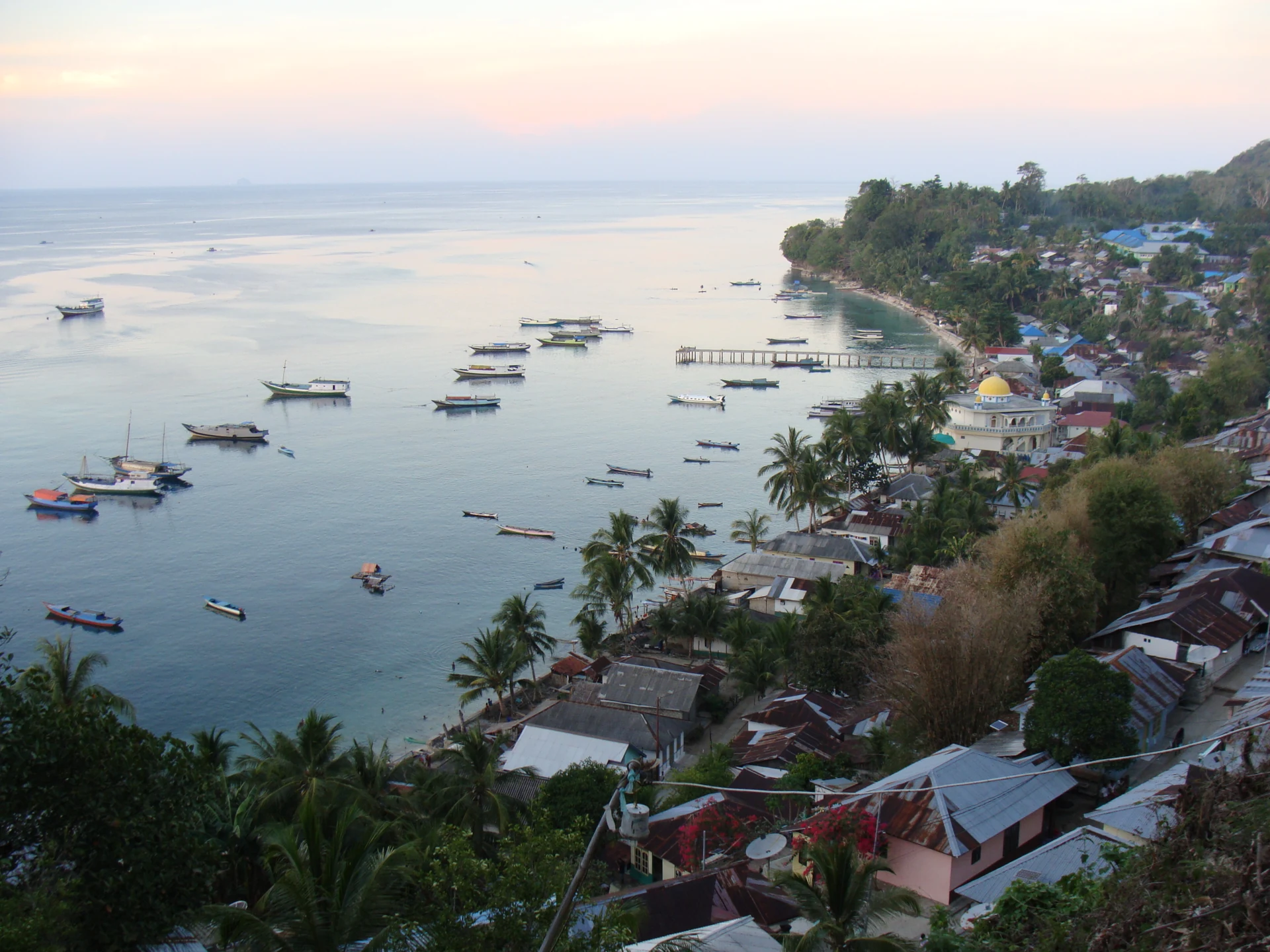
The islands are close enough for these connections to be visible from the shore. Tulehu harbour stands on eastern Ambon, facing the channel towards Haruku; beyond are Saparua and Nusa Laut, where Ameth is one of the coastal villages. The short crossings lead out from Ambon into the former clove-growing zone. They carried food and people as well as spice, joining communities whose livelihoods depended on what could be brought from another shore.

Rumphius and the islands beyond Ambon

Among the VOC employees living on Ambon was Georg Eberhard Rumphius, who devoted years to collecting shells and studying plants. Islanders supplied specimens, local names and knowledge of how plants and animals were used. Material also arrived through the trading routes beyond Ambon: he obtained bird-of-paradise plumes said to come from Sergile, around present-day Sorong. Waigeo’s traders carried sago and pearl shell towards Salawati and Tidore, and bird skins travelled west through Raja Ampat. Goods reaching his hands could carry knowledge from shores he had never visited.

Rumphius lost his sight in 1670 and continued with assistants. Four years later, his wife and youngest daughter died in an earthquake while watching Chinese New Year celebrations. A fire in 1687 destroyed his house, drawings and manuscripts; later, the ship carrying the first six books of his Herbal to Europe sank. A copy made in Batavia saved that work. His Ambonese Curiosity Cabinet appeared after his death in 1705, and the Herbal followed between 1741 and 1750. In 1990, researchers returned to Ambon with his descriptions, searching the beaches and bays he had named for the marine animals he had studied three centuries earlier.

View on the map

Passing up the harbour, in appearance like a fine river, the clearness of the water afforded me one of the most astonishing and beautiful sights I have ever beheld. The bottom was absolutely hidden by a continuous series of corals, sponges, actiniae, and other marine productions of magnificent dimensions, varied forms, and brilliant colours. The depth varied from about twenty to fifty feet, and the bottom was very uneven, rocks and chasms and little hills and valleys, offering a variety of stations for the growth of these animal forests.

Alfred Russel Wallace, 1869
A hillside view of a coastal settlement with metal-roofed houses, palms, a white domed building, a pier and many small boats.
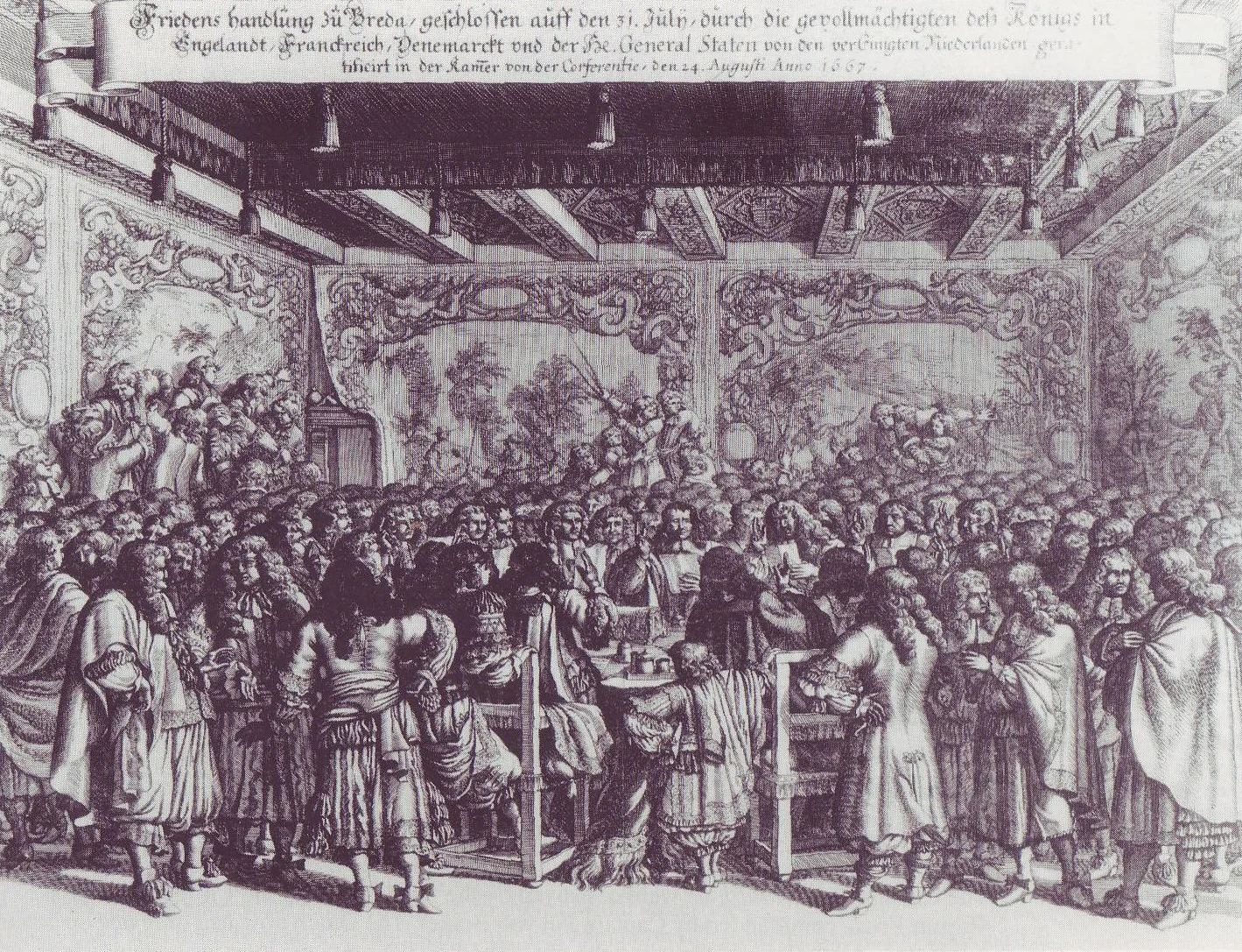
A monochrome engraving of people in a richly decorated hall, gathered around a central table beneath an inscribed banner.

04 Rhun / Run · a settlement across oceans

Rhun and the Treaty of Breda

In December 1616, the English merchant Nathaniel Courthope reached Rhun with two ships, the Swan and the Defence. The agreement he made with Bandanese leaders included an unusual gift: a branch of nutmeg would be sent each year to King James I. The islanders wanted English protection for their people, property and religion, and help recovering neighbouring Ai from the Dutch. In return, they offered their allegiance and exclusive sales of their spices to English buyers. For Courthope, this gave England a claim in the heart of the nutmeg islands; for his allies, it brought the promise of help against an immediate enemy.

Delivering that help proved much harder than promising it. Courthope remained on Rhun while messages from English commanders encouraged him to hold out, but the reinforcements he needed failed to arrive. By 1620, his allies had lost people and resources waiting for support. That October, a Dutch vessel intercepted his boat as he returned from Banda Besar. He was shot in the chest and went overboard, never to be seen again. England’s claim to Rhun survived him and continued to trouble its relations with the Dutch for decades.

Diplomats kept returning to the island’s disputed status. In 1654, the Treaty of Westminster allowed the English to settle there, but the VOC continued obstructing them into the early 1660s. With the outbreak of another Anglo-Dutch war, Dutch forces destroyed Rhun’s nutmeg trees and expelled the English merchants.

Across the world, the English were already taking territory from the Dutch. In 1664, warships arrived off New Amsterdam, the settlement at the southern end of Manhattan, and its governor, Peter Stuyvesant, surrendered. The colony of New Netherland extended far beyond the island: its trade followed river routes inland, where Dutch merchants had built a business buying furs from Indigenous communities. Farms and settlements had grown around that trade. England therefore gained an established colony, with land, inhabitants and commercial connections, several years before the negotiators met at Breda.

By the summer of 1667, both sides were fighting a war whose consequences reached across several oceans. London was recovering from plague and the Great Fire, while much of the English fleet lay idle in the Medway. Dutch ships entered the river, burned English warships and towed away the Royal Charles. Peace talks had already begun, but the raid put greater pressure on Charles II to reach a settlement. The delegates gathered in the great hall of Breda Castle had to decide which conquests would be reversed and which would be accepted.

The peace signed on 31 July 1667 left England holding New Netherland, including Manhattan, while the Dutch retained Suriname and Rhun. This is the connection behind the familiar story of Rhun being exchanged for Manhattan, although the agreement settled a much wider struggle and recognised possessions already taken by force. For the Dutch, keeping Rhun strengthened their hold over the nutmeg islands; England retained its foothold on the North American coast. The English claim that had outlived Courthope was finally relinquished.

The Dutch celebrated the peace alongside the naval victory that had helped secure it. A bronze medal from 1667 places Peace on a pile of captured weapons, with an olive branch in her hand; turn it over and English ships are burning near Chatham. The name of the Dutch commander, Michiel de Ruyter, appears in the lettering.

Even then, the fighting between the two countries was not finished. Another war began in 1672, and the following year a Dutch fleet retook New York and renamed it New Orange. A further peace returned it to English rule in 1674. Dutch families, their language and their institutions remained through those changes of flag.

View on the map
Small rounded kernels are spread on white and yellow sacks, with dark broken shells, a hand tool and a metal cup nearby.
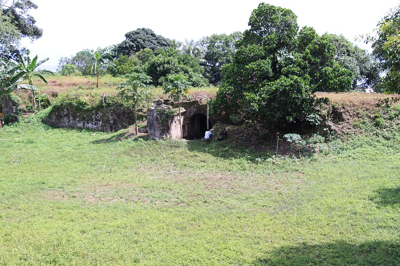
Low weathered stone walls and a dark arched entrance stand beside a grass clearing, with trees growing behind them.

05 Pulau Ai / Ay · the fort and the water

Ai: settlement and conquest

Fort Revenge takes its name from the Dutch return to Ai in 1616, when they avenged the defeat they had suffered there the year before. In 1615, Dutch troops had landed on an island whose growers were selling nutmeg to English merchants as well as other buyers. The VOC wanted those sales stopped. Its soldiers occupied Ai, but the islanders fought back and drove them out. The company had ships and soldiers close by on Neira, so the people of Ai had little reason to expect that it would accept the defeat.

The English had a commercial interest in keeping the island outside Dutch control, and in early 1616 they sent a small squadron to Banda. When a larger Dutch fleet confronted it, the English commanders initially prepared to fight. They then reconsidered the strength of their ships and crews and negotiated a withdrawal. The vessels that might have supported Ai sailed away, leaving the islanders to face the returning Dutch forces. An English flag over their defences did not prevent the invasion.

When the Dutch returned in 1616, their second attack succeeded. People tried to escape at night in overcrowded boats, and many drowned. Others retreated to a stronghold above the cliffs; as Dutch troops approached, they climbed down towards waiting boats, with some falling to their deaths. The conquest left an almost empty island. Among the people brought in to replace its inhabitants were 450 from Siau, including their ruler, transported through deception and coercion. Water shortages and poor treatment followed, and most of the Siau people soon escaped.

On the site of the defeated community’s stronghold, the Dutch built Fort Revenge, with five sides and a bastion at each corner. Company directors in the Netherlands objected to paying for another fort in Maluku, but officials in the Indies went ahead. Keeping a garrison there also required a dependable supply of water. Rain was collected and filtered into cisterns built within the walls and beneath the raised ground behind them, so the soldiers could maintain their post.

Beyond the walls, the nutmeg groves were divided into colonial estates. Historian Frank Dhont gives 31 plantations on Ai in his account of that division, drawing on an account published in 1873 by N. P. van den Berg. The crop grew on ground quite different from the central volcanic islands: Ai is made of uplifted limestone, with a flatter, drier landscape. The trees still produced the spice that merchants wanted, but the land was now worked within the company’s plantation economy.

The fort stayed in use as generations of workers cultivated the surrounding estates. An earthquake badly damaged it in 1683, and repairs were followed by a different use for its rooms: in the eighteenth century, senior company officials and other high-ranking captives were imprisoned there. Another restoration followed in 1753. The fort remained in use until the end of the eighteenth century.

One plantation gateway carries the name Welvaren, Dutch for prosperity. You can see it in Muhammad Fadli’s photographs for The Banda Journal. He and the writer Fatris MF returned to Banda repeatedly, spending time there through harvests, dry weather and storms. They visited plantations and homes, taught children, attended weddings and spent evenings talking with residents. Among the old forts and estate buildings, they found families whose livelihoods still depended on spice trees, and whose conversations moved between memories of violence and the cost of everyday necessities.

View on the map
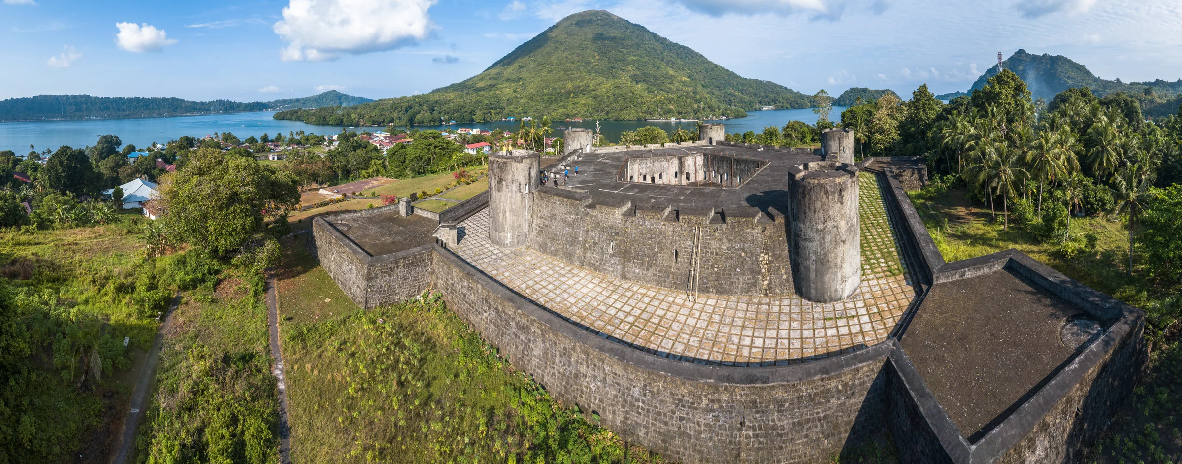
A wide view of a stone fort with round corner towers, roofs and palms below it, and a cone-shaped hill across the bay.
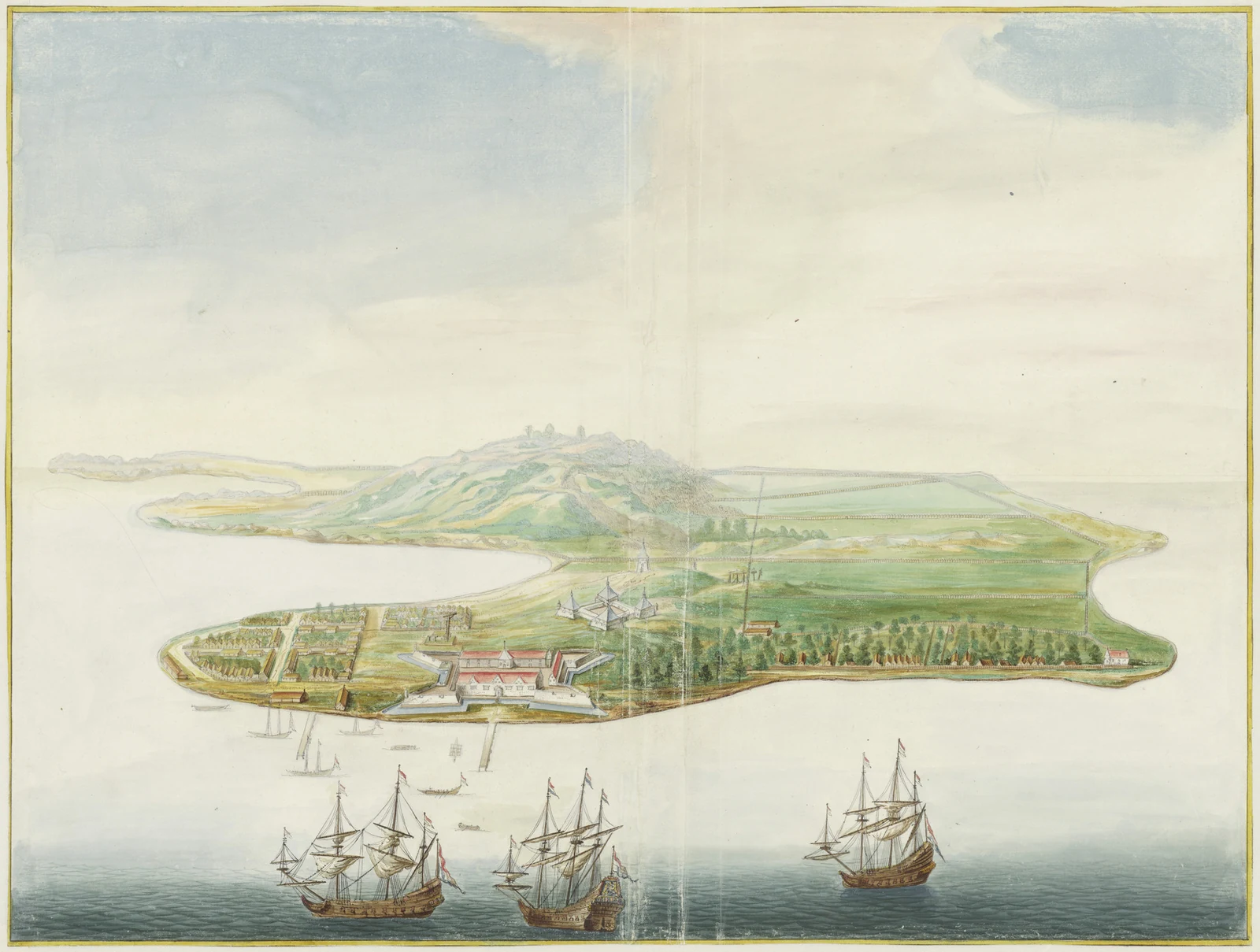
Bird’s-eye watercolour of an island with forts, houses and rectangular planted enclosures, with sailing ships and boats offshore.

06 Banda Neira · conquest and plantation labour

Banda Neira and the VOC

Outside Fort Nassau on 8 May 1621, 44 Bandanese community leaders were put to death. They were orang kaya from Lontor, across the water from Neira, and had survived interrogation before the new governor, Martinus Sonck, convicted them of treason. Japanese soldiers in VOC service carried out the executions. An eyewitness heard one prisoner ask in Dutch whether there was no mercy before the executioner cut off his head. On Lontor, Bandanese were starved in hilltop strongholds and hunted by Dutch patrols when the forts fell.

The fort outside which the men died had already been a source of conflict for twelve years. In 1609, Admiral Pieter Verhoeff arrived with an armed fleet and demanded permission to build on Neira. While the orang kaya delayed their answer, he sent men ashore to begin work. They then invited him to negotiations and ambushed and killed him and his companions. His fleet attacked coastal settlements and boats in retaliation. When an agreement was finally reached that August, Nassau was already standing, with a permanent Dutch garrison on land Verhoeff had entered without permission.

Under Governor-General Jan Pieterszoon Coen, the VOC conquered Banda through killing, enslavement and expulsion. The destruction of Bandanese society was part of a policy discussed within the company for years. In 1615, its directors had already backed killing and expelling Bandanese leaders and replacing the population. Their aim was to secure the nutmeg trade by taking control of the people who produced it. Families were driven from their homes, and survivors faced deportation or enslavement. Historian S. J. Miske identifies this deliberate destruction of the population as genocide.

The land was divided into perken, plots leased to private planters called perkeniers. They could sell their produce only to the VOC, at prices fixed by the company. Enslaved workers supplied by the VOC cultivated the groves and prepared the harvest. They included Bandanese survivors and people brought from the Indian subcontinent and elsewhere. The new owners still needed Bandanese knowledge of the trees. Some people deported to Batavia were therefore brought back to Banda, where they were forced to work in the groves they had known before the conquest.

Taking possession of the groves did not give their new owners a reliable harvest. Tall shade trees remained among the nutmeg, and shortages of food and workers troubled the estates. Historians differ on how much the Dutch changed cultivation: Vincent Loth argued that production was reorganised and intensified, while Miske’s later archival study finds considerable continuity and yields that initially stagnated or fell. The company could demand spices at a fixed price, but planters still depended on people who knew how to keep the trees productive.

We can follow some of those households through what they left behind. On Banda Besar, archaeologist Amy Jordan excavated three plantations, including Ordatang, which stood on a ridge along an old caldera, away from the beach. It was abandoned by the time she worked there; elsewhere, old plantation buildings had been taken apart for materials or incorporated into newer homes. Fish bones, cooking pots and imported dishes survived in the ground. Some pottery came from the Ambon–Lease region, and traces of plant foods remained on the ceramics, allowing Jordan to investigate how people obtained and prepared their meals.

The contrast with Neira was striking. Imported dishes and clay pipes were much more common at the town’s elite sites than on the estates Jordan studied, where the objects were closer to those found in village households. This suggested that the owners spent much of their time in town. Across the water, the people working the groves were obtaining food and household goods through their own connections with nearby islands, while continuing to cultivate the crop the planters sold.

From Neira, Fort Belgica overlooked Nassau and the harbour below. Around 1662–1663, both forts appeared in a painting made in Johannes Vingboons’s workshop for the VOC’s rooms in Amsterdam. Its houses, shoreline and defences joined a series of views of company settlements across Asia.

Bandanese life also continued beyond these islands. Communities on Kei Besar trace their origins to people who left Banda around the time of the conquest. In Banda Eli and Banda Elat, descendants speak their own Bandanese language, tur wandan, and pass on accounts of their ancestors' journeys. Women sing onotani, songs of travel that tell of departures, landings and the founding of new communities. They also speak of missing family.

View on the map

Banda is a lovely little spot, its three islands enclosing a secure harbour from whence no outlet is visible, and with water so transparent, that living corals and even the minutest objects are plainly seen on the volcanic sand at a depth of seven or eight fathoms. The ever smoking volcano rears its bare cone on one side, while the two larger islands are clothed with vegetation to the summit of the hills.

Alfred Russel Wallace, 1869
A pile of red lacy strands lies beside dark oval seeds in a pale bowl on a woven surface.
An engraved portrait shows a man with swept-back hair wearing a dark coat and a light neckcloth, with his name printed below.

07 Mauritius · the movement of living plants

Nutmeg beyond Banda

On 7 December 1778, governors, officials and other guests gathered in the royal garden on Mauritius to watch Jean-Nicolas Céré harvest a nutmeg. Its tree had grown from a nut planted eight years earlier. The ceremony was reported in the island's newspaper, and Céré asked for the nut to be sent to Paris for presentation to Louis XVI. A fruit picked in a colonial garden had become evidence that France could grow a valuable spice previously obtained through Dutch-controlled trade.

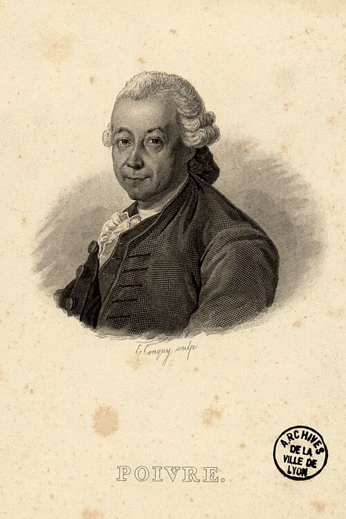
Getting the plants to Mauritius had taken years of negotiation and repeated attempts. Pierre Poivre, the French administrator known as the intendant, sponsored secret collecting expeditions while the island was still called Isle de France. The later voyages were led by navy officer Jean Mathieu Simon Provost. French ships could not simply arrive in Dutch territory and collect what they wanted. Malay intermediaries and Maluku islanders helped them obtain plants through connections reaching across the many islands of the eastern archipelago. Successful shipments reached Mauritius in 1770 and 1772, following more than two decades of effort.

Keeping the plants alive was another difficulty. Nutmeg seeds quickly lose their ability to germinate, so a long voyage could leave a collector with nothing that would grow. Of Poivre's early shipments in 1753 and 1755, only two plants survived. The French had already offered a reward in Pondicherry for anyone who could supply 25 living nutmeg plants. A merchant could buy dried spice, but a government hoping to establish its own groves needed living material.

Poivre also needed to convince people in France that his collectors had obtained the right plants. Specimens travelled to Paris in glass containers filled with alcohol, their labels carrying Malay names. There, the naturalists Michel Adanson and Bernard de Jussieu examined the fruits and tried to reconcile those names with the botanical books available to them. The gardeners on Mauritius had living trees in front of them; the men judging the shipment in Paris were working largely from preserved fruits. Names and specimens had crossed the ocean together, but much of the growers’ knowledge had not.

On Mauritius, much of the work fell to gardeners and enslaved cultivators. One was Charles Rama, an enslaved Bengali who became head gardener in Poivre's private garden and knew how to cultivate nutmeg. Instructions also drew on experience from Ambon and Banda and on Rumphius's botanical work. Growers had to adapt that advice to different soil, rain and winds. Poivre recommended sheltering young spice plants among bananas. Written directions could still be misunderstood: some settlers confused a developing root with a stem and planted sprouting nuts upside down, killing them.

Nutmeg was already travelling west before the celebrated Mauritius harvest. France had considered growing spices in Guiana after the Seven Years War, and instructions to send nutmeg went out in 1771. A shipment from Mauritius reached Cayenne on 3 February 1773 after 64 days at sea. There the imported trees could be grown and used to supply further gardens. The movement into the Caribbean took longer. In 1802, during the Peace of Amiens, two young nutmeg trees were smuggled from Cayenne to St Vincent, where another colonial garden was trying to establish the crop.

By the beginning of the nineteenth century, a new grove no longer had to begin with a voyage to Maluku. Seedlings could come from Mauritius or Cayenne, where introduced trees were supplying further transfers. The work had continued long after the collecting ships returned: islanders supplied the plants, crews carried them through long voyages, and gardeners raised the surviving trees until they produced fruit.

View on the map
A single-storey white house has a broad red-brown roof, pale shutters and an open veranda facing a narrow paved street.
Black-and-white portrait of a man in a light, open-collared shirt.

08 Banda Neira · 1936–1942

Hatta and Sjahrir in exile

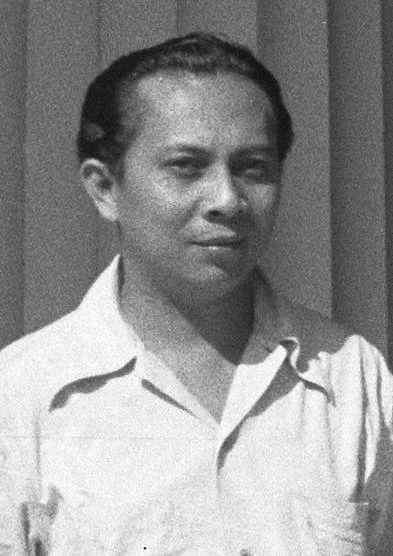
Before Mohammad Hatta was sent into exile, he was allowed to leave prison long enough to pack his books into sixteen chests. He had been arrested in 1934 for nationalist activity, and was being sent to Boven Digul in New Guinea. Among the possessions he took were the books he would continue to read and use in his teaching. They travelled into confinement with him, although he could not choose when he would be allowed to return home.

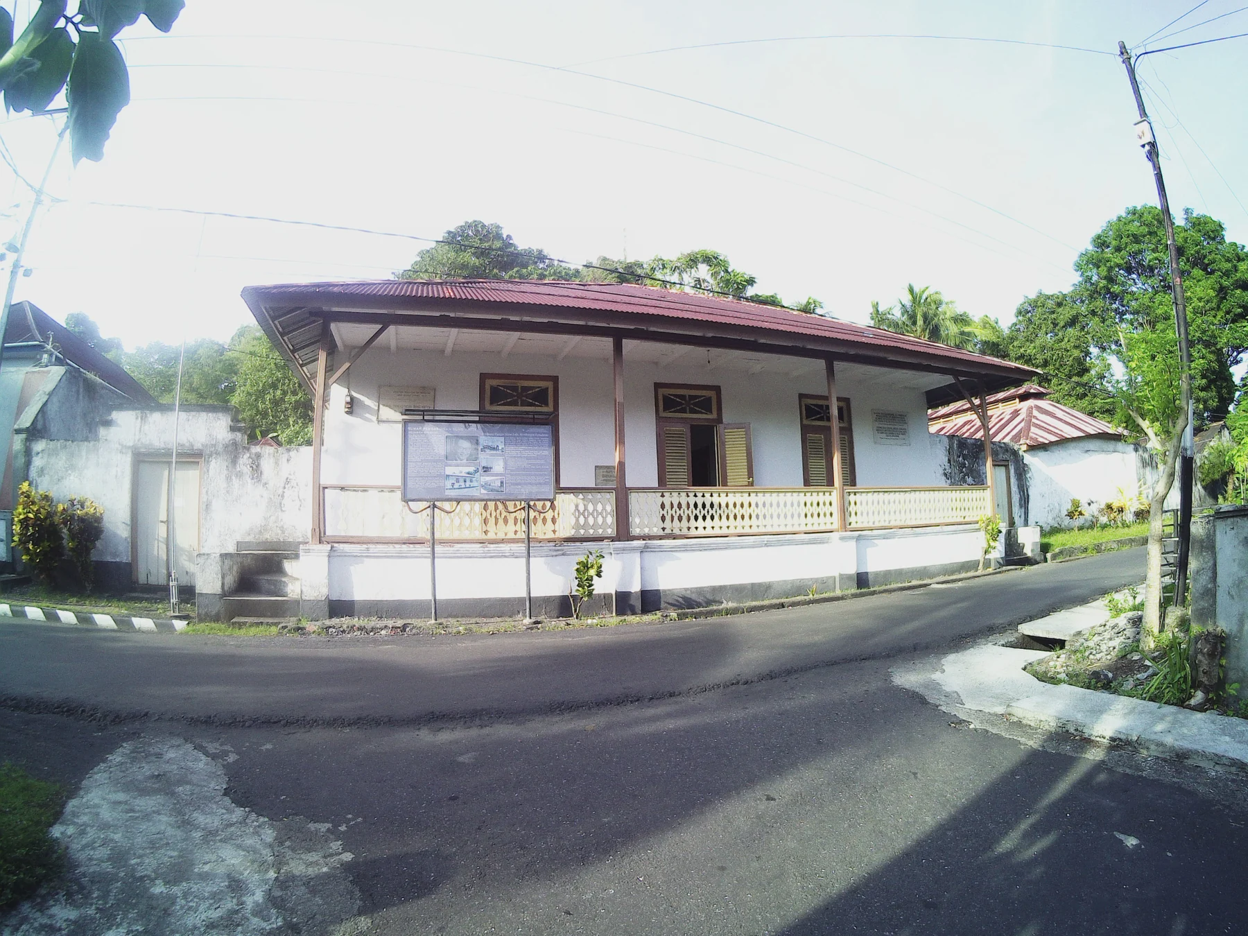
Hatta and another nationalist, Sutan Sjahrir, arrived on Neira aboard the Fomalhaut on 11 February 1936. They had been transferred from Digul, and a crowd gathered to meet them. Dr Tjipto Mangunkusumo, an older nationalist already living in exile on the island, took them into his home until they found somewhere of their own. They were still detainees, but here they could move among the island's families, receive visitors and continue their correspondence. Both eventually established separate households in the town.

An afternoon school brought children to the back veranda of Hatta's house. There were wooden tables, chairs and a blackboard, and pupils included children who had little opportunity to continue their schooling elsewhere. Hatta taught the older ones, Sjahrir the younger. Reading, writing, arithmetic and languages filled the lessons; learning Dutch could open the way to further education. As we pass through Neira, those domestic spaces belong to this history too: children came to a neighbour's house to learn from men the colonial government had removed from political life.

Their pupils encountered two quite different teachers. Hatta kept a disciplined routine, beginning his day with bathing, prayer, coffee and reading, and expected children to take their work seriously. Sjahrir was more at home playing and talking with the younger ones and getting to know their parents. One of those children was Des Alwi, who became Sjahrir's pupil and part of his household. Des later remembered the loneliness of a man separated from his wife and political friends, and the companionship that grew between him and the children. He knew the two men as Uncle Hatta and Uncle Rir.

Hatta and Sjahrir also became students themselves. At the home of their fellow exile Iwa Kusumasumantri, they met Bahlawan, a Bandanese Arab teacher. Hatta, Sjahrir, Iwa and Tjipto studied Arab history with him, while Iwa also learned Arabic, Qur'anic interpretation and Islamic history. The men had arrived with their own books and political ideas, but their conversations now included a teacher whose home was Banda.

Books continued to arrive from Batavia and Europe, and both men prepared articles for publication. Their reading reached from German philosophy and French literature to the politics unfolding beyond the Netherlands Indies. Sjahrir also wrote to Maria Duchâteau, who remained in the Netherlands. Much of that correspondence was written in Banda and later appeared in English as Out of Exile. The distance between them runs through letters that also turn to politics, culture and events he continued to follow from the island.

Their departure came suddenly in 1942, as Japanese forces advanced into the Netherlands Indies and the Dutch ordered them back to Java. During the occupation, Hatta worked publicly alongside Sukarno, while Sjahrir organised underground. After independence, they became Indonesia's first vice-president and first prime minister respectively. Their houses remain on Neira, including the back veranda where the children came for their afternoon lessons.

Buru: Pramoedya's years in prison

On Buru, west of Ambon, prisoners had to build the barracks in which they would live. They felled trees, cleared fields and cut roads by hand. By then Indonesia was independent: these men had been sent there by Suharto's government during its repression of the political left. Among them was the writer Pramoedya Ananta Toer, who was imprisoned on Buru from 1969 to 1979. He had been detained after his home was attacked in 1965 and his books and papers burned. Hunger, forced labour and the threat of violence filled the years in which he composed the novels later known as the Buru Quartet.

After his release, Pramoedya worked with two other former prisoners, Joesoef Isak and Hasyim Rachmat, to publish what he had written. This Earth of Mankind appeared in 1980 and was banned the following year. Child of All Nations, Footsteps and Glass House followed, and each was banned too. His prison memoir, The Mute's Soliloquy, grew from letters to his children that he had been unable to send. When it appeared in Indonesian in 1995, the authorities banned that book as well.

View on the map
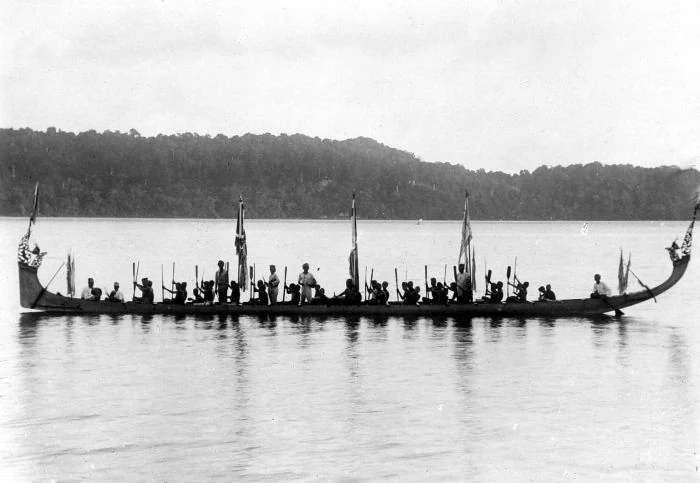
A black-and-white photograph shows a long boat with many seated people, paddles, several flags, and high curved ends against a wooded coast.
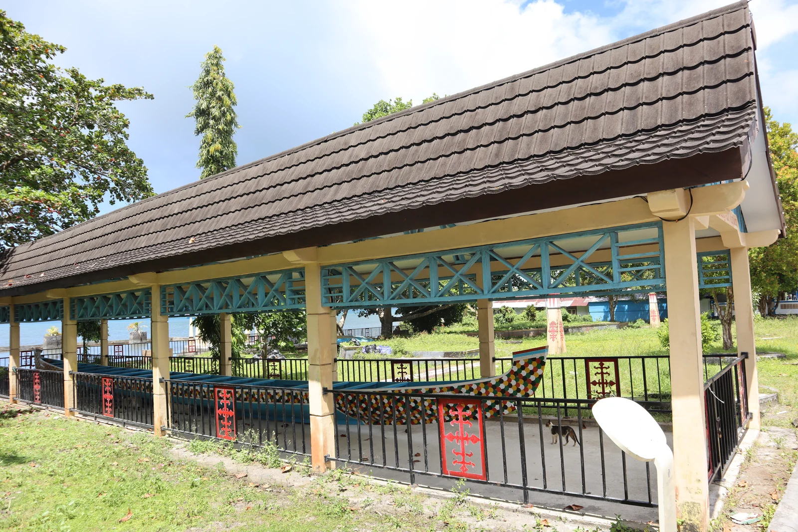
A long painted wooden boat rests inside an open pavilion with a tiled roof.

09 Banda · boats, songs and customary authority

Belang, kabata and Mama Lima

A decorated belang brings a village onto the water. The paddlers handle the boat together while voices carry the kabata, songs through which communities tell of places, journeys and their past. These boats, also called kora-kora, take part in competitions between villages, with carved and painted details that have meanings within their own traditions. By the time a boat joins the race, preparations have already taken place ashore, in the village's customary house, the rumah adat, and at sacred places known as keramat.

For the Buka kampong ceremony, people meet to arrange the proceedings, carry offering baskets to sacred places and prepare the dancers' clothing, shields and swords. Bamboo is cut for an archway and for the poles used in the cakalele warrior dance. The poles require special care: they must be carried back without touching the ground. Each village follows its own sequence and customs; the work involves knowing which materials to gather, where to take them and who is responsible for each stage.

Among those responsible are the Mama Lima, groups of five women who help decide how ceremonies are carried out. They prepare ceremonial objects and costumes and help dress the younger women and girls taking part. Their authority reaches into customary law, religious life and the care of the community. These offices normally pass through families, with replacements appointed when necessary. Younger participants have their own places in the ceremony: before beginning the cakalele, the dancers pay their respects to the women and girls.

The songs belong to a wider tradition of telling how people came to Banda and established their communities. In 1922, Saleh Neirabatij of Lonthoir wrote a Malay hikayat, illustrated with ships and containing verses intended for public recitation. In its traditional origin story, Cilu Bintang and her brothers build a vessel, travel to Majapahit and Mecca, and bring Islam to Banda. The manuscript was long thought lost by researchers before it was recognised in Amsterdam's National Maritime Museum in the 1990s. Its drawings and verses can now be read alongside the songs still performed in Banda.

In Lonthoir, anthropologist Phillip Winn asked a ritual leader how adat, the community's inherited customs and obligations, fitted together with religion. The man hooked his index fingers around one another and pulled, showing that he could not separate them; a healer in Selamon used the same gesture. In these communities, Muslim prayers, Qur'anic readings, incense and the participation of the imam belong within customary observances. Founding figures called datu connect the community to its place. For families of different origins, taking part in these duties is also a way of belonging to the negeri, both the community and its territory.

These shared customs existed alongside religious divisions that became violent in 1999. On 19 January, a fight involving a Christian transport driver and a Muslim youth in Ambon escalated into communal attacks. Mobs burned houses and places of worship, people were killed, and families fled. Security forces sometimes failed to intervene and sometimes shot civilians. Rumours and reprisals helped the fighting grow, against a background of political and economic tensions following Suharto's fall. When the violence reached Banda Neira, the Old Church was burned and members of its Christian community were killed. Almost the entire Christian community subsequently left the island.

In 2000, Laskar Jihad brought armed fighters into Maluku from outside the islands, while Christian militias were also fighting and modern weapons became more common. Muslim and Christian delegates signed the Malino II agreement on 12 February 2002, although attacks continued and serious violence returned in 2004. Estimates differ, but several thousand people were killed and hundreds of thousands displaced. Peace negotiations were taking place between national and religious leaders while, closer to home, people were trying to find safe ways to trade and move between neighbourhoods again.

In Wayame, on Ambon, Muslims and Christians had organised joint night watches while the fighting was still going on. A team of ten people from each community investigated rumours before anyone acted on them. Christian and Muslim women held regular meetings and made the shared market a priority, so that people could continue buying food, selling their goods and meeting one another. Elsewhere, local leaders negotiated safe places to trade, and neighbours began visiting again for funerals, weddings and religious holidays.

View on the map
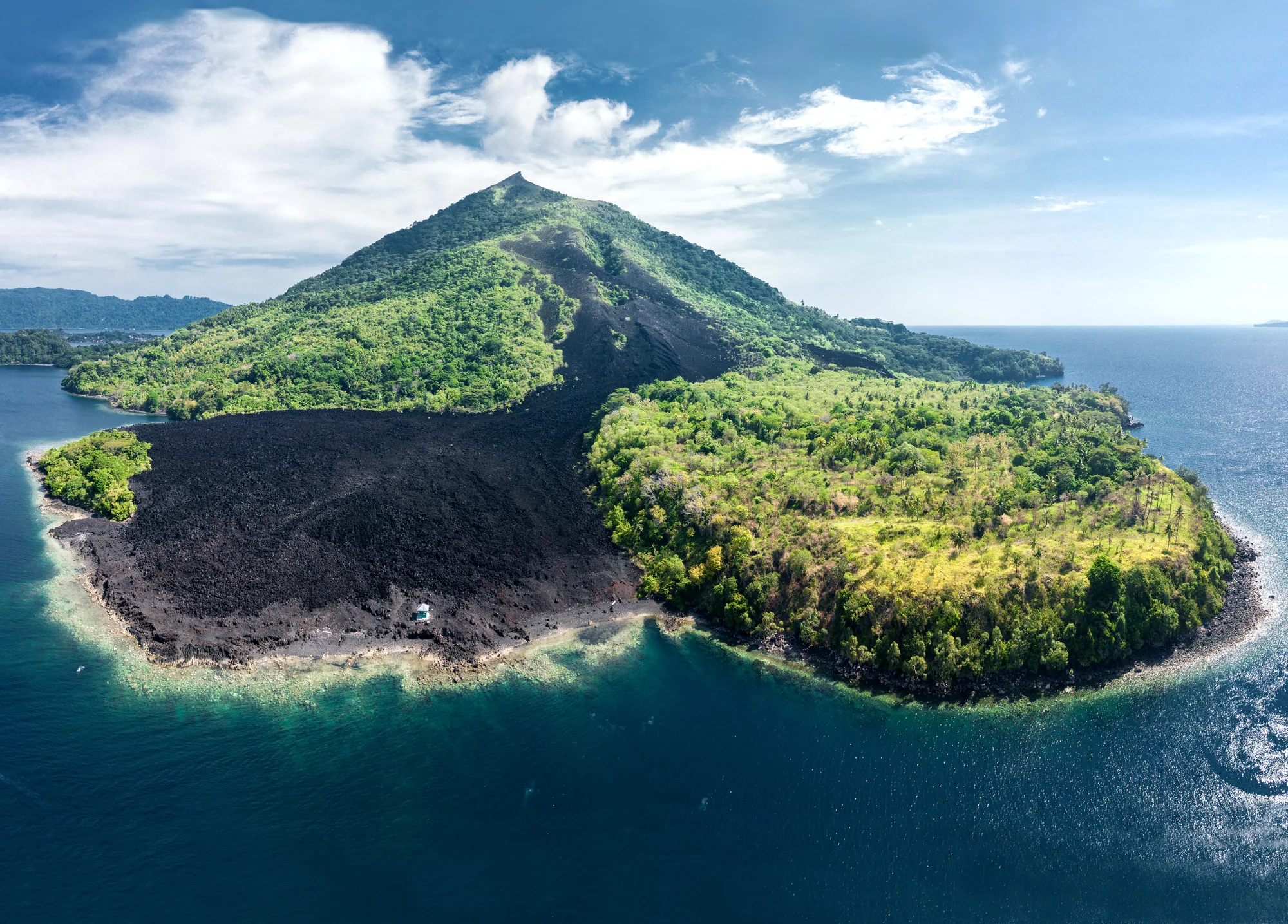
Aerial view of a cone-shaped hill with green vegetation and a broad dark band of bare ground extending to a curved shoreline.
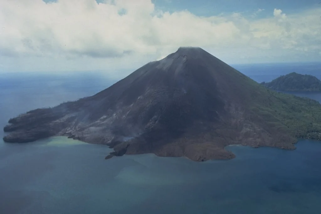
Aerial view of a largely bare volcanic cone, with dark rock extending down to blue water.

10 Gunung Api · eruption and the return of coral

Banda Api’s 1988 eruption

In May 1988, people on Neira were feeling earthquakes every few minutes. Across the narrow channel, Banda Api was home to about 1,800 people. Staff at the observation post on Neira monitored the shocks with a seismometer and radio. At 6.30 on the morning of 9 May, the volcano erupted.

Ash columns rose three to five kilometres above the northern and southern flanks, while lava moved towards the shore. By 11 that morning, the flow at Batu Angus had reached the sea; another entered the water at Pasir Besar. Half an hour later, the southern eruption column bent towards western Lontar, spraying ash and rock fragments across its tip in a blast lasting less than a minute. Explosions weakened over the following days, and by 18 May the craters were quiet.

Three people died, two in a boat accident during the evacuation. By late May, more than 7,000 residents of Gunung Api, Neira and Lontar had been evacuated to Ambon. On 13 June, the volcanological survey recommended a return to Neira and Lontar, but Gunung Api’s residents remained displaced on Ambon, Seram and Lontar.

When researchers returned five years later, they found coral growing on a sheltered lava flow beneath the sea. Their survey identified 124 species, with living coral covering an average of 61.6 per cent of the area examined. Table-shaped Acropora colonies were prominent, some already more than 90 centimetres across. This particular flow supported more coral, and a greater variety, than the nearby older limestone reef that the lava had missed.

For coral to grow there, the cooled rock first had to receive living settlers. Many reef-building corals release eggs and sperm into the water, where fertilisation produces tiny larvae. Currents carry them away from their parents until they settle on a suitable surface. A larva then becomes a polyp: a small animal with a mouth and tentacles. As polyps multiply, they build the hard calcium carbonate skeleton beneath the living tissue. Microscopic algae living inside many reef-building corals help supply the energy for this growth through photosynthesis, while the polyps also catch food from the water.

The shape and firmness of the new seabed helped explain what followed. Researchers compared the lava with both the older reef and loose volcanic deposits elsewhere around the island. They proposed that the solid, uneven lava offered a stable place for young corals to attach, with spaces that could shelter them from predators. Nearby reefs offered an existing source of larvae. Loose deposits that shifted beneath a new settler were less suitable.

Decades later, researchers returned to the lava-flow reef to watch corals reproduce. Between 2016 and 2019, they observed spawning peaks in April and October–November, mainly five to seven days after the full moon, two to three hours after sunset. To collect eggs while divers were away, they placed inverted household funnels over colonies and attached plastic bottles above them. Returning the next morning, they could retrieve eggs released during the night.

Keeping anchors off the reef

Keeping boats above a reef without dropping anchors onto it has become another concern around Banda. In April 2025, crews installed mooring buoys at six sites around Rhun, Manukang and Hatta. Each buoy gives a boat a fixed place to tie up, with its anchoring system positioned away from living coral. Village representatives worked with university staff, conservation workers and fisheries officers on the installation. On Hatta, village leader Sudar Raharusun offered the community’s help with looking after the new moorings.

View on the map
Several sharks, some with broad T-shaped heads, swim above a dark reef beneath bright, rippled surface water.

11 Banda Sea · life below the surface

Hammerheads in the Banda Sea

A hammerhead’s outline is familiar long before you see one in the water. The head spreads sideways, with the eyes set towards its ends and a curved mouth underneath. In a scalloped hammerhead, the front edge has a central notch and smaller indentations that give the species its name. Behind it is a slender body and a tall first dorsal fin. These are the scalloped hammerheads, Sphyrna lewini, recorded gathering around the Banda Islands.

That broad head carries sensory equipment across a much wider surface than a pointed snout would provide. Small pores beneath it connect to organs that detect weak electrical fields, including those produced by other animals’ muscles. As the shark moves through the water, these signals help it locate prey. Researchers comparing hammerhead species have found different arrangements of these pores across their heads.

A scalloped hammerhead also moves through different surroundings as it grows. Young sharks use shallow coastal nursery areas, while adults spend more time offshore, around island margins, continental shelves and neighbouring deep water. Their food includes fish, squid, octopus and crustaceans, as well as other sharks and rays. The adults we might see beside an island have already spent part of their lives in shallower coastal waters, and can travel far below the depths reached by divers.

Researchers in Hawai‘i found a way to follow some of those deeper journeys. They attached instruments that measured the sharks’ depth, movements and muscle temperature. These warm-water animals descended into water around five degrees Celsius, cold enough to draw heat rapidly from their bodies. Yet their muscles stayed warm through most of the dive. The sudden cooling came later, as the sharks approached the surface. To understand that pattern, the researchers had to consider what was happening at the gills, where water flowing past would carry body heat away.

The team’s explanation was that the sharks reduced the flow of cold water over their gills, holding on to heat while temporarily interrupting their oxygen intake. Video of a scalloped hammerhead more than a kilometre deep showed tightly closed gill slits. After only a few minutes at the bottom of a dive, the tagged animals headed back towards warmer water.

Around Banda, observations from Hatta, Rhun, Ai and Suanggi have helped identify an Important Shark and Ray Area for scalloped hammerheads. Larger groups are reported from mid-September to early December, with smaller groups reported throughout the year. The local records come from divers’ observations and surveys rather than the tracking work carried out in Hawai‘i. They show repeated gatherings in these island waters, although the reason for their gatherings is still unknown.

Fishing can reach scalloped hammerheads across that range of habitats. Young sharks are accessible to fishers in coastal nurseries, while adults travelling in groups can be caught together in nets and on longlines. Some are caught accidentally in fisheries targeting other animals; others are taken for their meat and fins. The fin trade is a major source of pressure on the species. Scalloped hammerheads are now classed as Critically Endangered on the IUCN Red List.

View on the map

Chronology

Across the centuries

  1. c. 5800–5600 BCEEarly visits to Ai
  2. c. 1500 BCENutmeg used in food on Ai
  3. 1304Banda named in the Dade Nanhai zhi
  4. 1602The VOC is founded
  5. 1605Hitu’s alliance and the surrender of the Portuguese fort
  6. 1616The conquest of Ai
  7. 1621The conquest of Banda
  8. 1623The Amboyna trial
  9. 1667The Treaty of Breda
  10. 1770–1772Living nutmeg plants reach Mauritius
  11. 1778Céré’s witnessed nutmeg harvest
  12. 1936–1942Hatta and Sjahrir in exile
  13. 1988Banda Api erupts
  14. 1999–2002The Maluku conflict and Malino II agreement
  15. 2025Moorings installed at six reef sites

Reading room

Explore further

Chapter 06 · Archaeology and food · Original paper · PDF

Spice Island Stew

Archaeological evidence for food and everyday life on colonial nutmeg plantations on Banda Besar.

49 min · works offline

Alfred Russel Wallace · 1869

The Malay Archipelago

Fifteen complete chapters from Banda, Ambon, the Moluccas, Kei and Aru.

The stories, map and reading room can be saved on this device. External articles need internet unless labelled otherwise.